LiDAR or Photogrammetry – Which one is better?
Drones make operations Safer, Efficient, Accurate, Quick, and way more Cost-effective compared to traditional practices. Drones are becoming increasingly popular in Surveying and Mapping, and this adoption can only be attributed to the huge array of benefits that come along with it. Drones allow you to conduct operations with a fraction of the workforce while improving efficiency and accuracy; moreover, drone-powered surveys and mapping are 75%-80% quicker than terrestrial measurement while giving you high precision and improved safety. For surveying and mapping professionals, LiDAR and Photogrammetry data-capturing techniques have been a part of the process. Now the only question that is troubling almost everyone – from amateurs to experienced drone professionals is – ‘Which one is better – Lidar or Photogrammetry?’ and naturally, the next question is – ‘DJI Zenmuse L1 or DJI Zenmuse P1? So let’s get into this dilemma.
DJI Zenmuse P1; Sub-centimeter GSD when Surveying & Mapping
Let’s talk payloads – Drone professional’s favourite photogrammetry tool, the DJI Zenmuse P1.
Did you know that P1 is DJI’s largest image sensor with the highest resolution? The Phantom 4 RTK – the closest competitor, has a 20MP sensor, which is 7.5 times smaller than the DJI Zemuse P1. There are a lot of exciting features to explore on P1, including its full-frame sensor, interchangeable lenses, the Smart Oblique Capture function and more. We hope this article will guide you to make better-informed decisions.
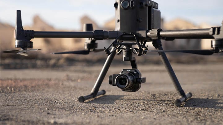
DJI Zenmuse L1; LiDAR Survey Made Easy
For a multitude of reasons, DJI’s first Livox LiDAR payload — the Zenmuse L1, is gaining a lot of traction among drone professionals. First of all, the DJI Zenmuse L1 incorporates the powers of both laser and visible light; this payload can simultaneously capture both LiDAR and Photogrammetry data. L1 is well known for capturing ‘accuracy’ by integrating a Livox LiDAR module, a high-accuracy IMU, a survey-grade camera, and additionally, it comes with a 3-axis stabilized gimbal. Well, not just that, there is a lot more to explore on this unparalleled player in the Drone-based solutions!
DJI M30 Series: The New Compact and Powerful!
DJI, the world’s leading manufacturer of drones, has just announced a brand new commercial drone – the DJI M30 Series. This is a significant release for DJI as it represents their first foray into the realm of large-scale drones. The M30 Series are packed with features and promises to be a game-changer for those in the commercial drone industry. In this blog post, we will explore some of the key features and changes that make the M30 Series so special.
Confessions of a Drone Professional: Why We Love the M300 RTK
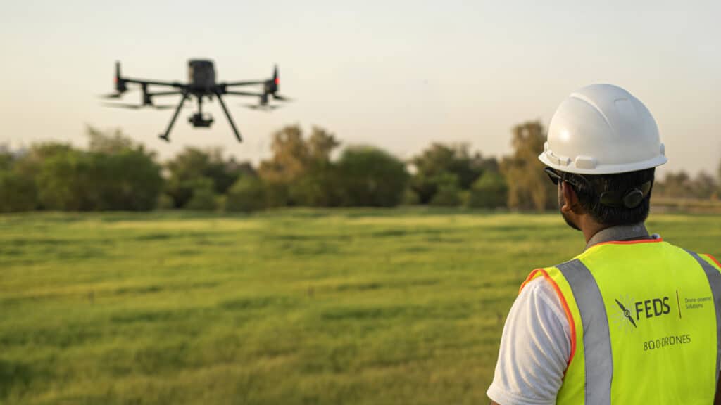
There is no doubt that DJI’s Matrice 300 RTK has set a new standard for the commercial drone industry. With its array of purposeful and powerful features combined with a robust build, you’d be hard-pressed to find better. However, this isn’t an article where we discuss the features of the M300 RTK — there are plenty of those already; in this article, we will be discussing why the pilots at FEDS-drone Powered Solutions love working with this powerful drone system.
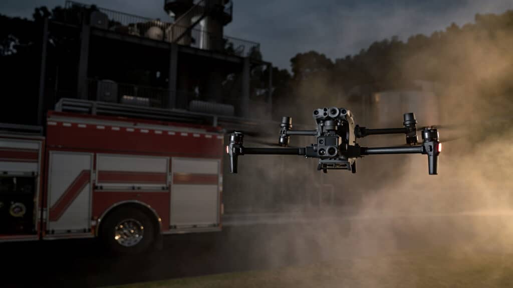
The Future of Fire and Safety with Drones
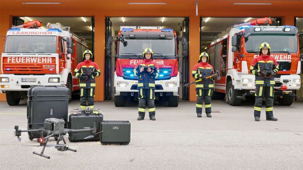
Firefighters have long braved hair-raising and dangerous situations, combating fires and saving lives. But, while this has been the norm for years— it no longer has to be with drones. The idea of rushing into unknown hazards and danger is what drones are here to change and improve fire and safety.
Emergency Response Drones: Saving Lives, Improving Response Times
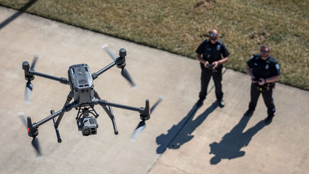
In an urgent response situation, the team and authorities are working against the clock. Traveling to the incident site, establishing situational awareness, and requesting additional resources all take time- precious time that can save lives. While traditional teams have to deal with road conditions, distance, and longer deployment times, drones do not. Emergency Response Drones are life savers. Emergency response teams are now leveraging drones to save lives, improve response times and optimize resource allocation.
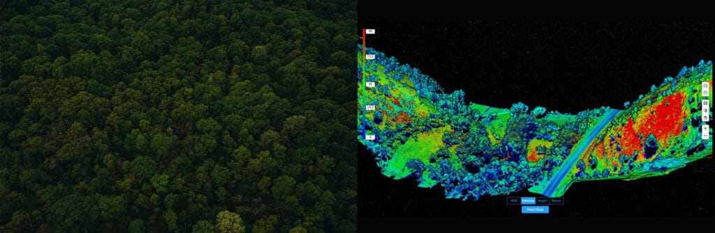
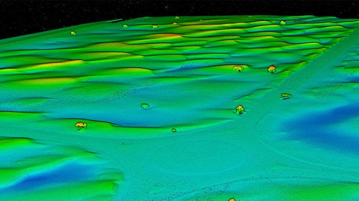
How DJI Zenmuse L1 Makes Right of Way Surveys Flexible and Practical
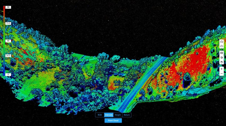
Right of Way (ROW) Surveys are tricky but incredibly important to Power & Utilities companies looking to expand their power grid. Especially in areas with dense vegetation and tree growth, in these areas, photogrammetry cannot provide bare ground level elevations. Without a reliable DTM (Digital Terrain Model), the next set of substations and power lines cannot begin. This is where LiDAR comes in. Using drone-powered LiDAR -DJI Zenmuse L1, we were able to survey the modest stretch of land quickly, efficiently and cost-effectively.
Our Findings on LiDAR Mapping Solution – DJI Zenmuse L1
Announced late last year, DJI’s first Livox LiDAR payload- the DJI Zenmuse L1- was set to change the game. The L1 comes seamlessly integrated with the DJI M-300 and DJI Terra software, giving you a completely self-sufficient ecosystem. We were excited to test out the new system and took it to the field as soon as we got it; here are our findings.
How is DJI Zenmuse P1 Resolving the Problem of a Texture-less Desert?
Precise & Rapid – These are some of the fundamental requirements of Geographic Systems. SfM (Structure from Motion) software is often at the core of drone photogrammetry; it is the method of choice for processing data from surveying, mapping and remote sensing. In this case study we will take a look into the issue of a ‘textureless’ desert and how DJI Zenmuse P1 solves this problem and makes mapping the deserts no longer a challenge.