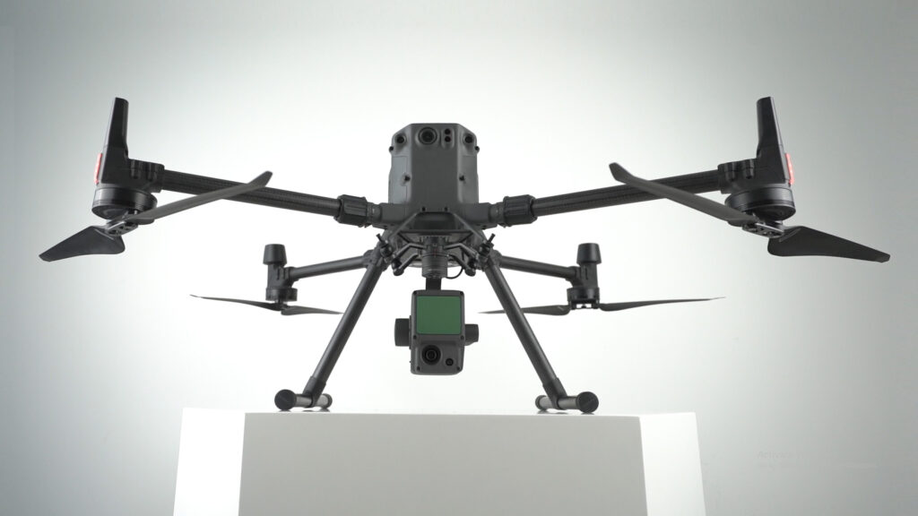
For a multitude of reasons, DJI’s first Livox LiDAR payload — the Zenmuse L1, is gaining a lot of traction among drone professionals. First of all, the DJI Zenmuse L1 incorporates the powers of both laser and visible light; this payload can simultaneously capture both LiDAR and Photogrammetry data. L1 is well known for capturing ‘accuracy’ by integrating a Livox LiDAR module, a high-accuracy IMU, a survey-grade camera, and additionally, it comes with a 3-axis stabilized gimbal. Well, not just that, there is a lot more to explore on this unparalleled player in the Drone-based solutions!
Real-Time 3D point cloud
The most cited advantage of L1 is the fact that it gives us a point cloud LiveView! Yes, while other payloads may display basic point clouds in real-time, the L1 gives you a real-time true-color point cloud. This provides drone operators with quick insight while on the site, enabling them to make instantaneous decisions in mission-critical situations. Likewise, you can also utilize this feature to ensure the integrity and effectiveness of the captured data, while still on the field.
Making LiDAR more Accessible and Affordable for Drones
Lidar payloads are generally expensive owing to the benefits that come along – even an entry-level LiDAR system costs around $35,000 (USD) and can go to the hundreds of thousands range. Fortunately, this is not the case with DJI’s Zenmuse L1. It is massively impressive how DJI has produced feature packed payload with powerful sensors at around the 10,000 USD cost point.
Non-repetitive scanning pattern
The DJI Zenmuse L1 is the only LiDAR sensor to facilitate both – a line-scan and a non-repetitive scan. Now the drone operators have to take the call on whether to go for a non-repetitive or a repetitive scanning method.
A non-repetitive scanning provides almost a circular Field Of View (FOV) resulting in a more accurate point cloud model, that too in a very short time. Whereas the repetitive scanning method provides a flat FOV, similar to the traditional mechanical, but still manages to give a slightly better result compared to traditional mechanical scanning methods.
The infographic depicts how the coverage and the point cloud density increase and reveals more detailed information about the surface.
Ready to fly, anytime
No more waiting for pristine weather conditions- Zenmuse L1 is ready when you are ready! L1 has got an IP54 rating, which implies that it can be operated in adverse weather conditions like snow, smoke, fog, or even at night. The ability to fly and capture data even in the dark combined with the LiveView feature makes Zenmuse L1 the ideal choice for Law Enforcement and Emergency Rescue.
In case of a crime/critical situation, drones can be deployed to instantly arrive at the incident area and acquire quick insights. Especially during the night— the L1 removes the limitation of visibility and allows officials to gather data in the thick of the night and even through canopy cover. This data proves to be invaluable in Search & Rescue missions.
LiDAR over Photogrammetry
LiDAR vs Photogrammetry— Is there a clear winner? In truth, it is situational and depends on your use-case. But, the Zenmuse L1 asks the question— Why not both?
A photogrammetric survey is not possible in low light conditions, or adverse weather conditions like snowfall or rainfall. As a result of these visibility constraints, photogrammetry methods cannot provide us with accurate data. Likewise, if there is vegetation that blocks the camera’s Line of Sight, then too, the accuracy of the measurement is not guaranteed. If you are looking for incredible accuracy, then you should definitely go with LiDAR.
True and Accurate Measurements
When capturing bare earth models, there are challenges. Especially when you encounter dense vegetation or foliage; and here is how the L1 solves them for you. It can effortlessly penetrate through obstacles like vegetation and foliage and return true and accurate measurements, making it ideal for topographic surveys, bare earth models and vegetation encroachment management.
The DJI Trio
DJI Trio is a fully self-sufficient ecosystem of the DJI line of products – that’s the drone platform DJI M300 RTK, Payload Zenmuse L1, and the Planning & Processing software – DJI Terra. Together it provides an exclusive end-to-end solution to our drone-based operations.
Data Processing
Exclusive to the DJI Zenmuse L1, DJI Terra has a bespoke LiDAR data processing solution. Combining both IMU and GNSS data the DJI Terra improves the accuracy of your 3D reality captures and renders enabling you with greater precision. Read more on the awesome powers of DJI Terra’s data processing in this article here, where team FEDS talks about how they completed a 30-minute drone survey in under 5 minutes with DJI Terra’s rapid data processing.
L1 gives you precise data across a variety of use cases. Now the question is – does it cater to your business goals? Considering the advantages of Zenmuse L1, it can be utilised for:
If you think L1 is the payload for you, feel free to get in touch with us. Or, you can arrange for a cost-free demo on how the L1 can improve your operations.