Exploring the Benefits of LiDAR Drone Systems: A Comprehensive Guide
LiDAR Drone solutions are revolutionising Mapping and Geospatial Data, and the future of this technology looks even brighter! Through this article, we intend to explore the Benefits and Applications of LiDAR systems, the advantages of Drone-powered LiDAR over ground-based solutions, and finally, have a closer look at DJI’s only LiDAR payload solution – the DJI Zenmuse L1.
DJI Drones for the Power and Utilities Sector
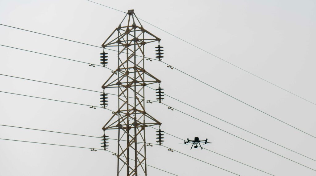
The Power and Utilities sector is undergoing a radical transformation. Technological advancements and rising consumer expectations are exerting pressure that demands new capabilities. You are at a point where you can’t really afford to move ahead assessing the efficiency of the assets with the same old traditional methods – by the time the traditional inspection is done, even a minor issue can develop into a catastrophic accident.
Are Drones invaluable for Disaster Management?
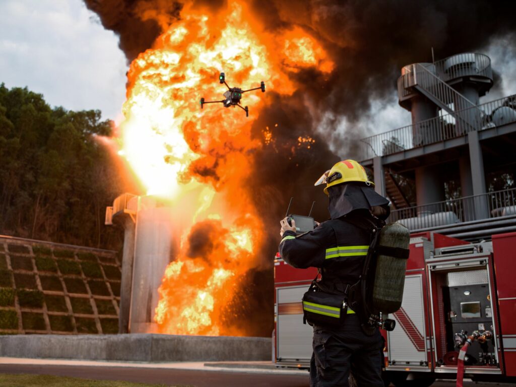
Disaster Management: Every single passing second feels like an eternity… Every split second could mean ‘Life or Death’ situation… Moreover, in disaster situations, first responders often bear the same life-threatening risks as the victims themselves; There is a need to save the lives of people caught in the heat of the disaster while also ensuring the safety of people involved in the rescue mission. We need an easy, affordable, quick, efficient and effective solution to aid disaster management, or simply put, we need DRONES!
DJI Drones for the Construction Sector
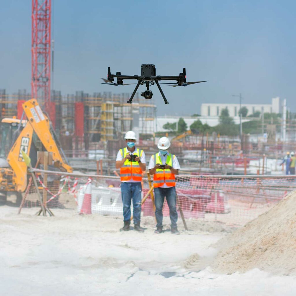
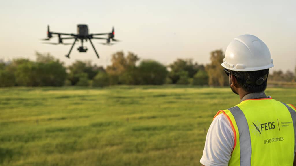
Have you ever felt a significant void in the construction sector? A report published by AutoDesk & FMI reported that insufficient project data and miscommunication are the cause of 52% of reworks on construction sites. These reworks translate to severe delays in the process, higher cost, labour, and significantly more. Apparently, comprehensive real-time monitoring is the need of the hour, and right now, drone-powered solutions are the only way to achieve this. Drone solutions can help us in every single step in the construction process – be it mapping the construction plot, construction progress monitoring, asset inspection and more. As per Allied Market Research, the construction drone market is expected to reach nearly $12 billion by 2027. Wondering why? The PwC report states that implementing drones in your construction efforts makes a crucial difference in managing costs, controlling risks, increasing safety and influencing outcomes.
DJI Drones for Public Safety
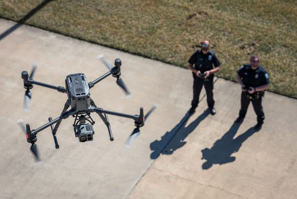
“Drones are one of the busiest assets in our organisation,” says Steve Mclinden, Group Manager, Mid and West Wales Fire and Rescue Services. A market survey reveals that DJI dominates the public safety sector, maintaining more than 90% of the market share. DJI is known to be the first responder to people’s needs. In the first-ever DJI product launch in the Middle East, Jony Ji, DJI Enterprise Sales Manager for the Middle East region, reiterated how DJI enterprise drones are designed upon the invaluable inputs from drone experts and enthusiasts.
LiDAR or Photogrammetry – Which one is better?
Drones make operations Safer, Efficient, Accurate, Quick, and way more Cost-effective compared to traditional practices. Drones are becoming increasingly popular in Surveying and Mapping, and this adoption can only be attributed to the huge array of benefits that come along with it. Drones allow you to conduct operations with a fraction of the workforce while improving efficiency and accuracy; moreover, drone-powered surveys and mapping are 75%-80% quicker than terrestrial measurement while giving you high precision and improved safety. For surveying and mapping professionals, LiDAR and Photogrammetry data-capturing techniques have been a part of the process. Now the only question that is troubling almost everyone – from amateurs to experienced drone professionals is – ‘Which one is better – Lidar or Photogrammetry?’ and naturally, the next question is – ‘DJI Zenmuse L1 or DJI Zenmuse P1? So let’s get into this dilemma.
How are DJI Drones Shaping the Future of Telecom Inspections?

The Telecom industry is an ever-evolving space, and so are the challenges associated with its operations and growth – managing vast, complex and remote infrastructures located in hard-to-reach and dangerous terrain is a real challenge. Amid these obstacles, telecoms need to keep their equipment sound and safe while also ensuring the safety of their inspectors. Wondering “how to effectively tackle these challenges”? Let’s find out how drones address these challenges to make the inspection process safer, faster and more effective. Likewise, this article discusses why DJI M3OO RTK is particularly the best player in Telecom Inspections.
Let’s Talk About DJI Drones for Surveying and Mapping
Have you ever sighed at the thought of surveying a large parcel of land? In the past, that is usually where drones come into the picture. Drones are just perfect for surveying and mapping— they fly over large areas in minutes to hours, they take pictures or videos from different angles, they keep you from having to traverse the dangerous terrain.
As surveying drones become more and more common with each passing day, let’s ask the question: how important are drones in your surveying and mapping operation?
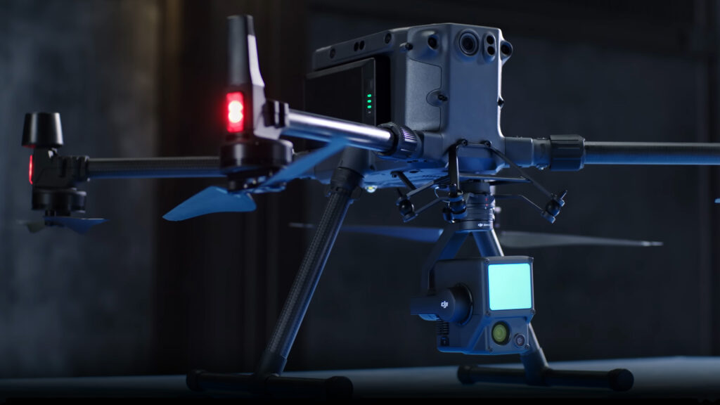
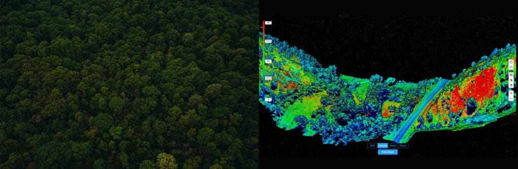
DJI Zenmuse L1; LiDAR Survey Made Easy
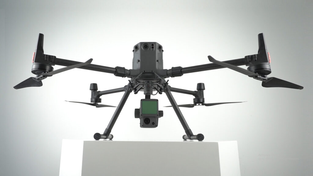
For a multitude of reasons, DJI’s first Livox LiDAR payload — the Zenmuse L1, is gaining a lot of traction among drone professionals. First of all, the DJI Zenmuse L1 incorporates the powers of both laser and visible light; this payload can simultaneously capture both LiDAR and Photogrammetry data. L1 is well known for capturing ‘accuracy’ by integrating a Livox LiDAR module, a high-accuracy IMU, a survey-grade camera, and additionally, it comes with a 3-axis stabilized gimbal. Well, not just that, there is a lot more to explore on this unparalleled player in the Drone-based solutions!
Confessions of a Drone Professional: Why We Love the M300 RTK
There is no doubt that DJI’s Matrice 300 RTK has set a new standard for the commercial drone industry. With its array of purposeful and powerful features combined with a robust build, you’d be hard-pressed to find better. However, this isn’t an article where we discuss the features of the M300 RTK — there are plenty of those already; in this article, we will be discussing why the pilots at FEDS-drone Powered Solutions love working with this powerful drone system.