A market survey reveals that DJI drones dominate the public safety sector; more than 90% of disaster response drone programs put their trust in DJI drones. DJI drones have saved over 940+ souls, have had a massive impact in 551+ rescue incidents, and have been deployed in over 39+ countries – these numbers are on the rise.
In the event of a disaster, real-time data is crucial. Drones can take off in the immediate aftermath of a disaster and equip responders with photos, live video streams, and GPS coordinates. Drones can immediately map the aftermath of a disaster. Likewise, drones can also help us with disaster preparedness by mapping areas prone to natural disasters. This will help the disaster response teams identify areas of high risk and implement plans to mitigate the potential damages. Let’s explore the various applications of Drones in Disaster Management while also discussing DJI drone solutions against each of your pain points.
Assessing Situations Remotely: Helicopters used to be our go-to solution for remotely analysing emergency situations. In this scenario, a pilot and small crew always had to be mission-ready to evaluate the breadth of the afflicted zone, the number of affected victims and so on. The entire examination procedure took a lot of time and money, and the health and safety of the pilot and crew members were also at stake. That is precisely when drones enter the scene – Drones address the challenges of traditional manned helicopter missions while providing better data. Drones can help with remote coverage of disaster-hit areas and can be deployed almost instantly. Drones can provide you with quick insights while also ensuring your safety.
Mapping Locations: Drone Mapping is instrumental both before and during the aftermath of a disaster. Mapping the areas prone to large-scale natural disasters is invaluable for disaster response efforts and insurance purposes. Emergency personnel can use this information to help coordinate search and rescue activities. At the same time, insurance companies can compare already-existing data to post-disaster data to accurately assess the severity of the damages and speed up the claim processes. Drones can even provide a 360-degree view of disaster-affected areas, allowing rescuers for a comprehensive inspection. The most significant advantage of drone technology is the GPS location and time stamps on the captured data. This is especially useful for disaster management as you have a visual representation of the area and location and time information, which translates to better visibility and access. Drones can also be outfitted with various robust cameras, spotlights and so on, allowing relief workers to locate heat signatures and spot subjects of interest that are invisible to the naked eye.
Search and Rescue: Unlike other Public Safety operations, Search and Rescue operations are more complicated and unpredictable due to the time constraints and terrain conditions involved. Moreover, experts have to work in life-threatening conditions without even realising what the results will be like. More often than not, rescuers are battling against the forces of nature to locate or establish a connection with the missing person- this can be in the form of dense vegetation, impassable terrain, extreme weather conditions and even the darkness of night. That’s exactly why we need drones – Unlike traditional ground-based operations, Drones are very fast, allowing us to reach the mission areas at the earliest. Moreover, they are equipped with robust sensors for the best possible visibility of ground objects. As a result, responders can easily map the search zone and identify all potential zones where the victim(s) may be located. For example, during a recent fire incident at Abbeco Tower in Sharjah, the Sharjah Police Force deployed drones to track residents trapped in the burning building and rushed emergency crews to rescue them. Likewise, drones equipped with Loudspeakers and Headlights are added advantage in this context; a victim can be spotted, and rescuers can even provide instructions to the people.
Delivering Urgent Supplies: When a tragedy strikes, the chances are extremely high that the victims may have to struggle without food, water, medicines or such necessities for several days. Drones are helpful in these situations for the quick delivery of basic needs. Emergency supplies encompass first aid, fast-acting medicines, and small tools for help, such as ropes and flashlights.
Airlifting Victims and Survivors: The most significant way to provide relief during exhausting and unexpected disasters is to help the wounded and injured. Besides supplying medicines and food, drones can also ferry human casualties in conflict zones. Once airlifted, immediate first aid is provided to ease the pain of the injured, proving to be highly effective in terms of cost, time, and other parameters.
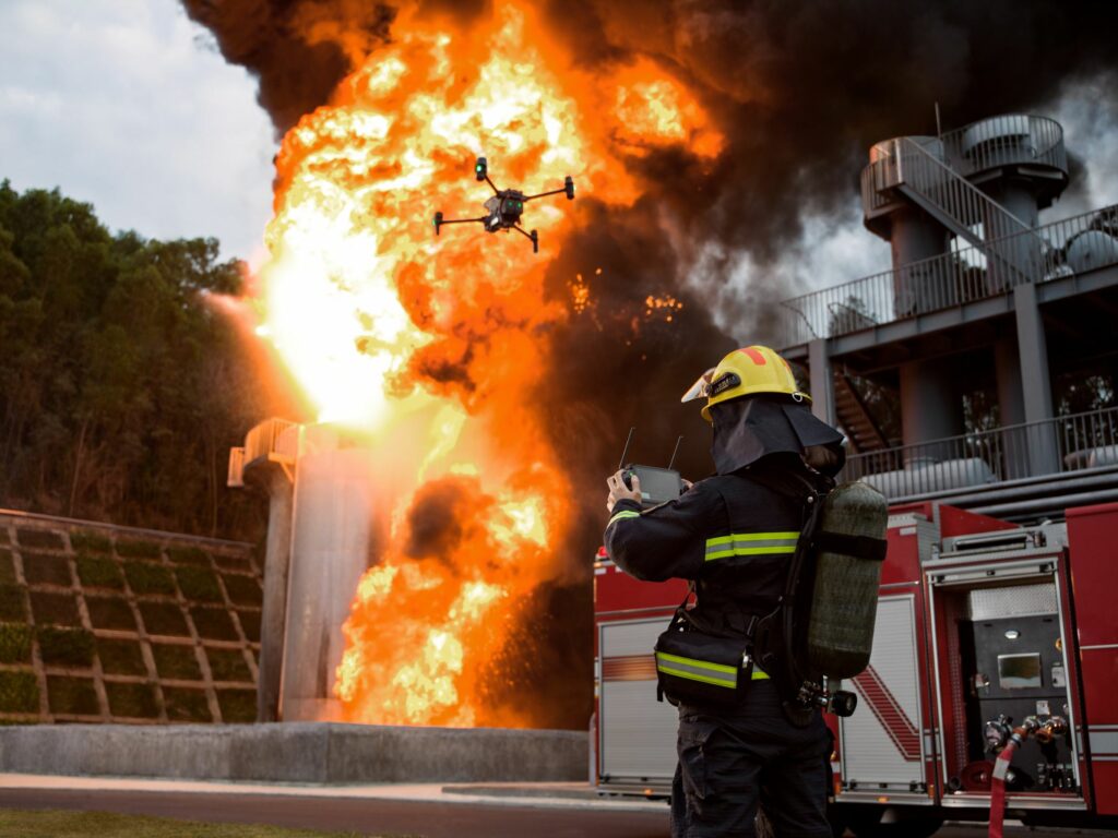
Extinguishing Fires: Fire breakthrough is one of the most common occurrences during a disaster. However, be it natural or manmade, fire breakthroughs are equally hazardous to humankind, flora and fauna, and the measures to extinguish fires are observed to be so time-consuming, labour-intensive, dangerous and cumbersome. This is when drones act as an unparalleled solution. Drones can effortlessly fly around in poor weather conditions and efficiently spray water or drop fire retardants, translating to resisting the occurrences or spread of fires. Furthermore, drones with communication systems can maintain touch with ground-based firefighters and the command centre, helping them effectively manage the fires.

Here is the story of how FEDS, one of the few ISO-certified drone solutions providers in the world, assisted in a city’s disaster recovery and mitigation efforts.
On August 4, 2020, a large amount of ammonium nitrate stored at the port of Beirut, Lebanon’s capital, exploded, killing at least 218 people and injuring 7,500, displacing an estimated 300,000 people. The blast damaged homes up to ten kilometres away. Surveying the affected regions was necessary to facilitate relief and restoration projects.

Traditionally, if you needed to capture this data, you would have to fly a manned aeroplane or helicopter mission combined with a crew on foot. This would have again turned up as an extremely time-consuming, resources-and- equipment-intensive process. However, the whole notion changed with Drone-powered solutions. Under just six flights, the team FEDS mapped the entire 6 sqkm areas within four hours, taking about 4,000 images. We then processed this data using Pix4Dcloud to have quick and better-informed decisions for this critical situation. Using survey and mapping projects, you get faster results while being safer and more accurate. Not to mention Disaster Management; providing access to quick and accurate data can make a huge difference in such critical situations.
DJI Mavic 3 Enterprise Series
DJI has introduced the all-new Mavic 3 Enterprise Series – DJI Mavic 3E and DJI Mavic 3T – setting new benchmarks for lightweight, compact and powerful commercial drone operations. These highly streamlined and compact series of drones can be handled with a single hand and can be deployed at a moment’s notice– translating to quicker and better-informed decisions during critical missions.
The Mavic 3E is primarily intended for efficient mapping and surveying operations, with improved performance in low-light conditions. Whereas the Mavic 3T is designed for aerial operations, specifically in firefighting, search and rescue, inspection and night operations. The standout feature of this drone is its thermal camera, which supports area temperature measurement, high-temperature alerts, colour palettes, and isotherms to help professionals find hot spots and make quick and better-informed decisions. In addition, these drones are compatible with Loudspeakers, text-to-speech support, and looping. This, in turn, escalates the efficiency of your search and rescue operations.

Mavic 2 Enterprise Advanced
The most noted advantage of the Mavic 2 Enterprise Advanced is that they are small and lightweight, making them quickly deployable. Basically, the Mavic 2 Enterprise series drones are first response solutions to get a quick hold of the situations. The M2EA can be deployed in fair weather for quick initial searches. The M2EA’s advanced visual sensor and the increased number of pixels compared to its predecessors are a big advantage. The ability to zoom in further than the other Mavic 2 Enterprise drones allows us to cover more ground and zoom in without having to bring the drones to dangerously lower altitudes. The 640 x 512 px thermal sensor places M2EA on par with other thermal sensors like the H20T and XT2, designed for larger drones like the M300 RTK.

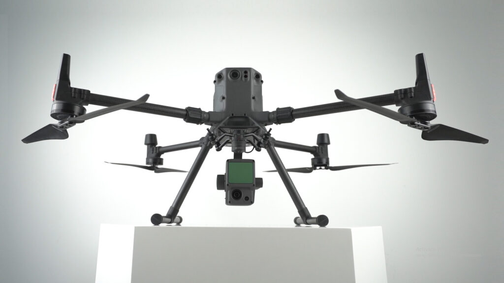
DJI M300 RTK
The DJI Matrice 300 RTK is undoubtedly a powerhouse of drone technology. The DJI M300 RTK is IP45-rated and is resistant to moisture, wind, and extreme temperatures, making the mission possible even in unpredictable weather. Likewise, it also gives us more impressive flight, making it ideal for prolonged searches, especially over huge rural areas.
Another notable aspect of the M300 RTK is its durability and endurance. For instance, the average wind speed in the windiest time of the year – is more than 9.2 m/s. That being said, turbulence and wind speed up to 11.97 m/s won’t affect the DJI M300 RTK. And most importantly, there will be more than enough time for you to complete your mission before you recharge the M300, which has a maximum flight time of 55 minutes. With smart tracking and advanced dual operator features, the DJI Matrice 300 RTK lets the pilots to concentrate more consciously on their mission rather than being concerned about controlling the drone as such. Moreover, with M300 RTK, the operators don’t have to waste time deciding what payload would be best for a mission; it can carry up to three payloads simultaneously, with a total take-off weight of 9 kg.

DJI M30T
The DJI M30/M30T is IP55 rated – the highest IP-rated drone that DJI has ever released. Moreover, the biggest advantage of the DJI M30/M30T is its highly compact and foldable design. With enterprise drones, we may need help with squeezing the drone into the car’s trunk. But guess what? The M30 can even fit a backpack! As a result, the operators don’t have to waste their energy or time figuring out how to transport the drone; and this convenient transport of M30/M30T translates into crucial time savings.
M30/M30T can fly into tiny spaces, which was previously unattainable by the enterprise drones. The enhanced visibility offered by the M3O series makes them incredible for search and rescue missions. Compared to the M300 RTK, the M30 has a slightly lower flight time of 41 minutes; however, it is half the weight of the M300 and has an improved IP Rating and wind resistance of up to 15 m/s. M30 is tailor-made for emergency services – an integration of power and portability! So the right way to perceive M30 is as an operations-escalator, an excellent entry-level solution that offers an invaluable addition to the existing drone fleet rather than an alternative to the current drones.

Now let’s discuss few powerful payloads – H20N, H20T, L1 and P1 – that do wonders with DJI M300RTK for public safety:
DJI Zenmuse H20N
The all-new DJI Zenmuse H20N is an incredibly powerful payload that facilitates low-light operations effortlessly. It has double-efficient starlight sensors (zoom and wide), making it the best for low-light scenarios. This allows operators to detect light sources as low as 0.0001 Lux— far beyond what the human eye can see. The Synchronised Dual Split-screen view is the headline innovation that makes the H20N stand out from the rest of its competitors. As the name suggests, the synchronised split-screen zoom lets the operators to simultaneously sync the zoom between the thermal and starlight night vision cameras. As a result, users can simultaneously scale both images, enabling them to compare details side by side during any critical mission. In addition, the H20N’s ability to perform night missions, its amazing durability and resilience, and the features mentioned above make it undoubtedly the best choice for disaster management initiatives, among many factors.

DJI Zenmuse H20T
DJI Zenmuse H20T is a powerful multi-sensor payload that is redefining the mission efficiency. H20T is a popular choice when it comes to thermal payloads. This is an invaluable asset in your fleet that does wonders during disaster management, especially in the event of a fire outbreak. It can help locate fires that are not yet apparent from the outside. It can help see through smoke and dust and even help find trapped people.
You can just tap on a point on the controller to get a real-time surface temperature reading. Likewise, you can also select an area to have a look at the lowest, highest, and average temperatures in the selected area. You’ll be notified in the DJI Pilot when object temperatures exceed your pre-set alert values. You can also visualise a specific band of temperatures to find what is more important. Likewise, you can change the colours applied to the thermal data based on your convenience.
The AI Spot-Check makes the H20T stand out from the rest of its competitors. With H20T, we can automate periodic inspections and capture results consistently. Likewise, the onboard AI detects the pre-marked subject, even in the subsequent automated missions. Re-inspection or another round of capturing the subject is no more a pain. Everytime you wish to re-inspect, the camera automatically frames the shot perfectly based on the pre-marked subject. Likewise, with the H20 T’s Smart Track feature, users can identify and track moving objects by automatically framing shots based on the pre-marked subject while simultaneously syncing the dynamic location of the subject.
DJI Zenmuse L1
While other payloads may display basic point clouds in real time, the L1 gives you a real-time true-colour point cloud. This provides drone operators with quick insight while on the site, enabling them to make quick better-informed decisions in mission-critical situations. In addition, L1 removes the limitation of visibility and allows officials to gather data in the thick of the night and even through canopy cover. No more waiting for pristine weather conditions- Zenmuse L1 is ready when you are ready! L1 has an IP54 rating, implying that it can be operated in adverse weather conditions like snow, smoke, fog, or even at night. The ability to fly and capture data even in the dark, combined with the LiveView feature, makes Zenmuse L1 the ideal choice for Law Enforcement and Emergency Rescue.
DJI Zenmuse P1
The P1 is DJI’s largest image sensor with the highest resolution. P1’s new global shutter can achieve speeds of 1/2000 seconds, enabling us to capture detailed images with absolutely zero distortion, even at high speeds. In addition, the full-frame sensor can take a photo every 0.7 seconds and offers incredible efficiency and accuracy while flying fast, improving the data capture rate. The P1 and DJI M300 RTK duo collect data five times faster than the DJI Phantom 4 RTK, making the combo effective, particularly for emergency situations. Moreover, with P1’s Smart Oblique Capture mode, its gimbal automatically rotates to capture images from whichever angle we want while flying along its flight path. P1 covers 7.5 sq.km in a single day, making it ideal for mapping during disaster management.

When mere seconds could mean the difference between life and death, drones can make a huge difference – “Drones can literally save lives!” Do you wish to add any of these powerful payloads or drones to your fleet? Feel free to get in touch with the Drone Centre to add these life-savers to your drone fleet. Our experts can guide you through the entire process, from consultation to helping you find the right drone, training your staff, and supporting your entire team to achieve excellence in your drone operations. Drop us a line at hello@thedronecentre.ae.