The white paper – ‘The Case For Drones In Energy’ – published by Measure, talks about how a reputed energy firm realised a 95% ROI for drone inspections on wind farms. Similarly, a drone-powered solar farm inspection costs 46% less than a manual inspection. Let’s explore more on the applications and advantages of drones in the Power and Utilities sector!
Drone-powered Solar Inspections: As per the Solar Energy Market Outlook report, the global solar energy market is expected to reach $223.3 billion by 2026, expanding at a Compound Annual Growth Rate of 20.5% from 2019 to 2026! Renewable energy makes up 29% of the world’s energy generation; out of this, Solar energy produces roughly 20% and is forecasted to grow. Solar Power is one of the most important sources of renewable energy. The ‘Return On Investment’ in the Solar Energy Sector becomes even more crucial both financially and environmentally.
When it comes to solar energy sectors, drones can help companies through the plant’s entire life cycle. From planning to routine inspections, drones coupled with the right payloads provide a massive boost in operations processes – better turnaround time & reporting, safer inspections, improved preventive maintenance and much more – making businesses more profitable. Coupled with artificial intelligence, drones can also help improve the layout of solar fields. Objects like transmission lines, a shadow from nearby vegetation, the slope of the landscape, and so on can be scrutinised and taken care of while finalising the layout. Automated Drone flights coupled with High-resolution cameras and Thermal sensors enable the detection of most of the faults or anomalies in the solar panel, hence preventing assets from being impaired. Any issue with a cell, panel or entire string will appear as hotspots to the thermal sensor. Here is a case study on how drones drive down inspection costs in the Solar Industry.


Drone-powered Telecom Tower Inspection: In the telecommunications sector, comprehensive real-time monitoring is the need of the hour, and right now, the only way to attain this is by switching to drones. Drones enable tower-specific flight automation, providing us with reliable data points. Furthermore, 3D virtual reconstructions or Digital Twins can be leveraged from the obtained datasets to deliver end-to-end visibility across tower infrastructures. This will help us to establish precise inventories of station equipment, measure their antenna tilts, identify rust, plan tower maintenance remotely and so on.
With proper flight planning, automated mode of data capturing, and smart data processing systems, drones can completely automate Telecom Inspections. Unlike the time-consuming, inefficient, and dangerous traditional inspections, drones just fly around the telecom towers and capture high-resolution images and 4k videos in just minutes. Based on the client’s requirements, the captured data is then sent over to the carrier network automatically or after post-processing.

Drone-powered Wind Turbine Inspection: The wind turbine blades have to be inspected as it helps us eliminate unplanned shutdowns by enabling us to preventively conduct maintenance during scheduled downtime. Severe deterioration of the blades or any sort of malfunctioning can result in major upheavals, which will, of course, result in extreme expenses. This is when the drones come into action. Combined with the right software, drones autonomously fly safely and collect high-resolution photographs, which helps in identifying even hairline ruptures.
To be compatible with the rise in demand for wind energy, manufacturers and wind farm operators opt for bigger turbine sizes. Even though this results in higher production of power, it also poses a toll on the turbines, as it becomes more sensitive to lightning and other depreciating environmental conditions. Here, drones can be adopted for LPS (Lightning Protection System) inspection and can even help with ‘predictive maintenance’, which means that you can act even before things get worse! As per the White Paper ‘The Case For Drones In Energy’ published by Measure – With demonstrated inspection time per wind turbine of 15-30 minutes, drones reduce man-hours and turbine downtime for maintenance checks by over 75%.

Drones in the Energy Sector make operations Safer, Faster, more Efficient, and way more Cost-effective, compared to the traditional practice of manned inspections. The automated mode of operation and the ability for real-time monitoring make it even more flexible and efficient. Having said that, now let’s dive deeper into the DJI solutions for the Power and Utilities Sector.
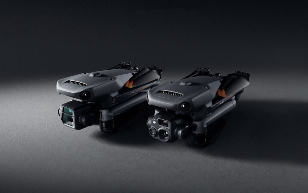
DJI has introduced the all-new Mavic 3 Enterprise Series – DJI Mavic 3E and DJI Mavic 3T – setting new benchmarks for lightweight, compact and powerful commercial drone operations. These highly streamlined and compact series of drones can be handled with a single hand and can be deployed at a moment’s notice.
The Mavic 3E is primarily intended for efficient mapping and surveying operations, with improved performance in low-light conditions. Whereas the Mavic 3T is designed for aerial operations, specifically in firefighting, search and rescue, inspection and night operations. The standout feature of this drone is its thermal camera, which supports area temperature measurement, high-temperature alerts, colour palettes, and isotherms to help professionals find hot spots and make quick and better-informed decisions. In addition, these drones are compatible with Loudspeakers, text-to-speech support, and looping. This, in turn, harnesses the efficiency of your operations in the time of emergency.
The most noted advantage of the Mavic 2 Enterprise Advanced is that they are small and lightweight, making them quickly deployable. The Mavic 2 Enterprise series drones are first response solutions to get a quick hold of the situations in the time of distress. However, M2EA can only be deployed in fair weather for quick initial searches; after the first round of inspection by the M2EA, more powerful drones like the DJI M300 RTK are used for in-depth data collection and analysis. It is to be noted that the M2EA’s battery capacity is limited, especially in cold weather.
The M2EA’s advanced visual sensor and the increased number of pixels compared to its predecessors are big advantages. The ability to zoom in further than the other Mavic 2 Enterprise drones allows us to cover more ground and zoom in without having to bring the drones to dangerously lower altitudes. The 640 x 512 px thermal sensor places M2EA on par with other thermal sensors in the market, like the H20T and XT2, designed for larger drones like the M300 RTK.

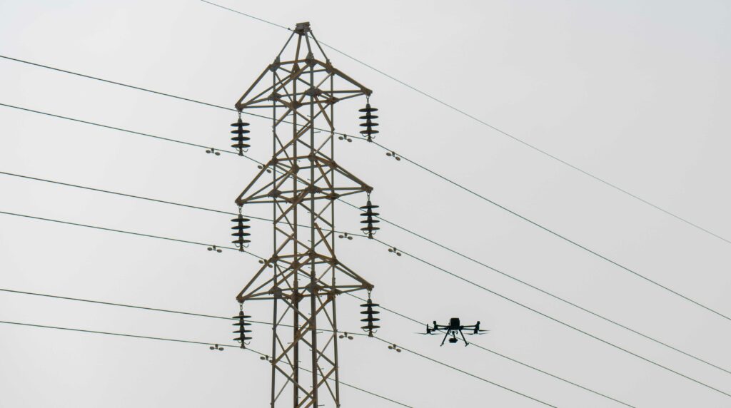
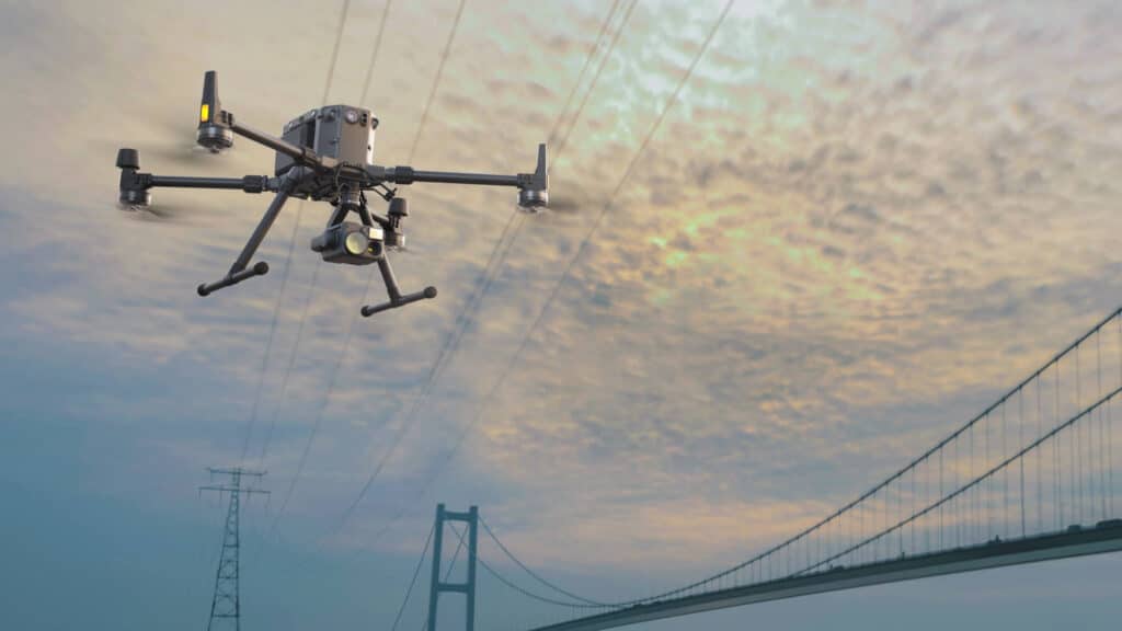
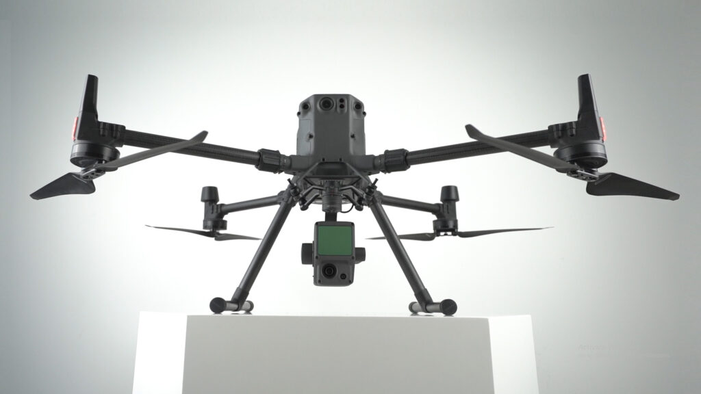
When it comes to the Power and Utilities sector, the DJI M300 RTK remains the crown jewel in DJI’s enterprise fleet. Let’s see why! The omnidirectional obstacle avoidance is exceptional when performing inspections to ensure the DJI drone doesn’t run into any powerlines or wind turbines and cause a safety hazard. The DJI M300 RTK is IP45 rated and is resistant to moisture, wind, and extreme temperatures, making the mission possible even in unpredictable weather – in this context, consider inspecting a powerline located at an unfavourable environment. Likewise, it also gives us more impressive flight time than the M2EA and P4RTK, making it ideal for prolonged searches, especially over huge rural areas. It is to be noted that the DJI Phantom 4 RTK and M2EA are not even IP Rated!
Another notable aspect of the M300 RTK is its durability and endurance. On average, inspecting a tower usually takes about 10 to 15 minutes. In that case, you’ll have more than enough time to complete the mission with the impressive 55-minute flight time before needing to recharge or swap batteries. Furthermore, with smart tracking and advanced dual operator features, the DJI Matrice 300 RTK lets the pilots concentrate more consciously on their mission rather than being concerned about controlling the drone as such. Moreover, with M300 RTK, the operators don’t have to waste time deciding what payload would be best for a mission; it can carry up to three payloads simultaneously, with a total take-off weight of 9 kg.

Now let’s discuss a few powerful payloads – DJI Zenmuse P1, DJI Zenmuse L1, DJI Zenmuse H20T – that do wonders with DJI M300RTK for the Power and Utilities Sector.
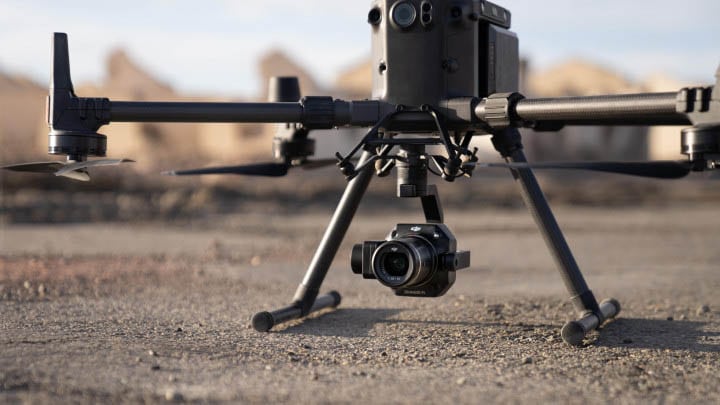
If you’re looking for a DJI drone to help you with inspections in your Power and Utilities initiatives, the Matrice 300 RTK with the Zenmuse H20T is a perfect choice. As we already discussed, powerful thermal sensors can be of great benefit to the Power and Utilities sector. The DJI Zenmuse H20T is a powerful multi-sensor thermal payload with advanced integrated thermal features. For instance, you can just tap on a point on the controller to get a real-time surface temperature reading. Likewise, you can also select an area to have a look at the lowest, highest, and average temperatures in the selected area. You’ll be notified in the DJI Pilot when object temperatures exceed your pre-set alert values. You can also visualise a specific band of temperatures to find what is more important. Likewise, you can change the colours applied to the thermal data based on your preference.
The Zenmuse H20 camera comes with a 20 MP zoom camera that allows you to get a close-up view of potentially dangerous structures without harming yourself. It also has a 12 MP wide camera to ensure that everything is in view. Moreover, with the AI Spot-Check, H20T can automate periodic inspections and capture results consistently. Re-inspection or another round of capturing the subject is no more a pain. Everytime you wish to re-inspect, the camera automatically frames the shot perfectly based on the pre-marked subject.
Dubai’s prestigious project – Mohammed bin Rashid Al Maktoum Solar Park is a massive solar park spread over a total area of 77 km2, which is soon expected to produce 5000 megawatts of power. Team FEDS was entrusted to inspect a phase of the Solar park. To make this inspection faster and more efficient FEDS chose to use DJI’s M300 paired with the H20T payload. Using this powerful duo, team FEDS were able to collect multi-faceted data enabling the engineers to perform visual and thermal inspections from the output of a single flight. You may read the entire case study here.
The P1 is DJI’s largest image sensor with the highest resolution. P1’s new global shutter can achieve speeds of 1/2000 seconds, enabling us to capture detailed images with absolutely zero distortion even at high speeds. In addition, the full-frame sensor can take a photo every 0.7 seconds and offers incredible efficiency and accuracy while flying fast, improving the data capture rate. The P1 and DJI M300 RTK duo, collect data five times faster than the DJI Phantom 4 RTK, making the combo effective, particularly for large mission areas. Moreover, thanks to P1’s Smart Oblique Capture mode, the P1’s gimbal automatically rotates to capture images from whichever angle we want while flying along its flight path. P1 covers 7.5 sq.km, that too in a single day – time saved is money saved!
The most cited advantage of L1 is that it gives us a point cloud LiveView. While other payloads may display bare point clouds in real time, the L1 gives you a real-time true-colour point cloud. This provides drone operators with quick insight while on the site, enabling them to make quick better-informed decisions in mission-critical situations. In addition, L1 removes the visibility limitation and allows us to gather data in the thick of the night and even through canopy cover.
No more waiting for pristine weather conditions – Zenmuse L1 is ready when you are ready! L1 has an IP54 rating, implying that it can be operated in adverse weather conditions like snow, smoke, fog, or even at night. The ability to fly and capture data even in the dark, combined with the LiveView feature, makes Zenmuse L1 the ideal choice for inspections.
Sustainability is the only way forward, and drones are at the heart of it. Do you wish to add any of these powerful payloads or drones to your fleet? Drop us a line at hello@thedronecentre.ae and let’s discuss how our drones or payloads can improve your operations.