I’m not sure if we could find a more impressive track record as DJI when it comes to drones in times of grief. DJI drones have saved over 883+ souls, have had a massive impact in 509+ rescue incidents, and have been deployed in over 39+ countries. And for obvious reasons, these numbers are on the rise. The applications of drones in the Public Safety initiatives includes Firefighting, Law Enforcement, Rescue Services, Disaster Management and more.

Firefighting: Firefighters are switching to drones paired with suitable payloads ranging from multi-gas detectors to high-resolution thermal and visual cameras. This enables them to make quick better-informed decisions when responding to critical emergencies. For instance, the live video feed from the drone camera will help firefighters safely steer through the area, identify hotspots, and find survivors.
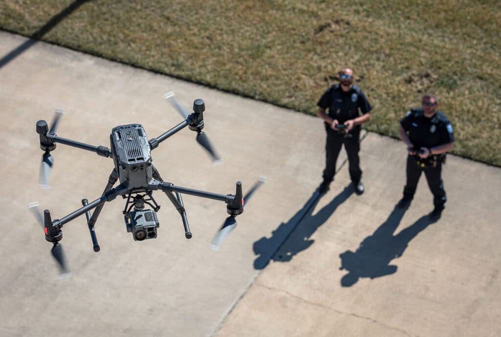
Law Enforcement: Law enforcement agencies are adopting versatile drone platforms to assist them with incident response, rapid mapping, and inspection to facilitate informed actions while also ensuring maximum safety for officers and bystanders. The police force and other types of law enforcement agencies are utilising drone technology in several ways, from tracking suspects to monitoring criminal activity-prone areas.
Rescue Services and Disaster Management: First responders worldwide are turning to DJI’s aerial solutions to assist them in their search and rescue missions. Drones can efficiently scan vast areas and help pinpoint lives in distress. In the event of a disaster, real-time data is crucial. Drones can just fly around the mission area while equipping responders with photos, live video streams, and GPS coordinates. Drones can immediately map the entire area hit by the aftermath of disaster. Likewise, drones can also help us for disaster preparedness by mapping areas that are prone to natural disasters. This will help the disaster response teams to identify areas of high risk and put plans in place to mitigate the damages that could arise.

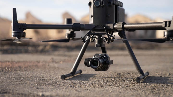
The most noted advantage of the Mavic 2 Enterprise Advanced is that they are small and lightweight, making them quickly deployable. Basically, the Mavic 2 Enterprise series drones are first response solutions to get a quick hold of the situations. But you know what, *conditions apply! For example, M2EA can be deployed in fair weather for quick initial searches. However, from what has been observed, after the first round of inspection by the M2EA, more powerful drones like the DJI M300 RTK are used for in-depth data collection and analysis.
The M2EA’s advanced visual sensor and the increased number of pixels compared to its predecessors are big advantage. The ability to zoom in further than the other Mavic 2 Enterprise drones allows us to cover more ground, and zoom in without having to bring the drones to dangerously lower altitudes. The 640 x 512 px thermal sensor places M2EA on par with other thermal sensors in the market like the H20T and XT2, designed for larger drones like the M300 RTK.

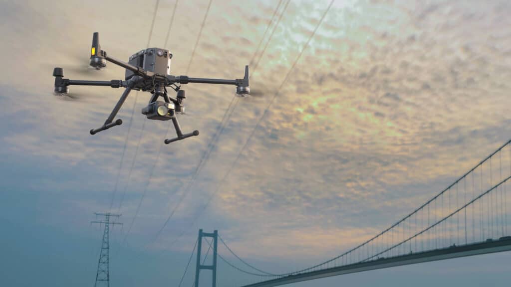
The DJI Matrice 300 RTK is undoubtedly a powerhouse of drone technology. The DJI M300 RTK is IP45 rated and is resistant to moisture, wind, and extreme temperatures, making the mission possible even in unpredictable weather. Likewise, it also gives us more impressive flight time than the M2EA, making it ideal for prolonged searches, especially over huge rural areas.
Another notable aspect of the M300 RTK is its durability and endurance. For instance, the average wind speed in the windiest time of the year – is more than 9.2 m/s. That being said, turbulence and wind speed up to 11.97 m/s won’t affect the DJI M300 RTK. And most importantly, there will be more than enough time for you to complete your mission before you recharge the M300, which has a maximum flight time of 55 minutes. With smart tracking and advanced dual operator features, the DJI Matrice 300 RTK lets the pilots to concentrate more consciously on their mission rather than being concerned about controlling the drone as such. Moreover, with M300 RTK, the operators don’t have to waste time deciding what payload would be best for a mission; it can carry up to three payloads simultaneously, with a total take-off weight of 9 kg.

“It looks like the M300 RTK and the Mavic 2 Enterprise Advanced had a baby” says Toby Knisely from DJI Enterprise, describing the M30 Series. Well, that’s true – the DJI M30/M3OT is a perfect balance of power and portability.
The DJI M30/M30T is IP55 rated – the highest IP-rated drone that DJI has ever released. Moreover, the biggest advantage of the DJI M30/M30T is its highly compact and foldable design. With enterprise drones, we may struggle with squeezing the drone into the car’s trunk. But guess what? The M30 can even fit a backpack. As a result, the operators don’t have to waste their energy or time figuring out how to transport the drone; and this convenient transport of M30/M30T translates into crucial time savings.
M30/M30T can fly into tiny spaces, which was previously unattainable by the enterprise drones. The enhanced visibility offered by the M3O series makes them incredible for search and rescue missions. Another noteworthy aspect is – large drones garb more attention, and this attention can be extremely dangerous in certain law enforcement operations. The compact and quiet operation of the M30 series helps law enforcement officers to monitor conditions or track people without inviting unnecessary attention. Compared to the M300 RTK, the M30 has a slightly lower flight time of 41 minutes; however, it is half the weight of the M300 and has an improved IP Rating and wind resistance up to 15 m/s.
Let’s make a quick comparison: The DJI M300 RTK offers you powerful versatility; meanwhile, Advanced still remains as a robust tool that is more cost-effective and portable than both M30 and M300 RTK. But you know what, M30 is tailor-made for emergency services – an integration of power and portability! So we believe that the right way to perceive M30 is as an operations escalator that offers an invaluable addition to the existing drone fleet, rather than an alternative to the current drones.
Now let’s discuss few powerful payloads – H20N, H20T, L1 and P1 – that do wonders with DJI M300RTK for public safety:

The all-new DJI Zenmuse H20N is an incredibly powerful payload that can effortlessly facilitate low-light operations. It has double-efficient starlight sensors (zoom and wide), making it the best for low-light scenarios. This allows operators to detect light sources as low as 0.0001 Lux— that’s far beyond what the human eye can see.
The Synchronised Dual Split-screen view is the headline innovation that makes the H20N stand out from the rest of its competitors. As the name suggests, the synchronised split-screen zoom lets the operators to simultaneously sync the zoom between the thermal and starlight night vision cameras. Users can simultaneously scale both images, enabling them to compare details side by side during any critical mission. In addition, the H20N’s ability to perform night missions, its amazing durability and resilience, and the features mentioned above make it undoubtedly the best choice for emergency operations, among many factors.
DJI Zenmuse H20T is a powerful multi-sensor payload that is redefining the mission efficiency. H20T is a popular choice when it comes to thermal payloads. Wondering why? You can just tap on a point on the controller to get a real-time reading of the surface temperature. Likewise, you can also select an area to have a look at the lowest, highest, and average temperatures in the selected area.
You’ll be notified in the DJI Pilot when object temperatures exceed your pre-set alert values. You can also visualise a specific band of temperatures to find what is more important. Likewise, you can change the colours applied to the thermal data based on your convenience.
The AI Spot-Check is something that makes the H20T stand out from the rest of its competitors. With H20T, we can automate periodic inspections and capture results consistently. Likewise, the onboard AI detects the pre-marked subject, even in the subsequent automated missions. Re-inspection or another round of capturing the subject is no more a pain. Everytime you wish to re-inspect, the camera automatically frames the shot perfectly based on the pre-marked subject. Likewise, with the H20T’s Smart Track feature, users can identify and track moving objects by automatically framing shots based on the pre-marked subject while simultaneously syncing the dynamic location of the subject.

The most cited advantage of L1 is the fact that it gives us a point cloud LiveView! While other payloads may display basic point clouds in real time, the L1 gives you a real-time true-colour point cloud. This provides drone operators with quick insight while on the site, enabling them to make quick better-informed decisions in mission-critical situations. L1 removes the limitation of visibility and allows officials to gather data in the thick of the night and even through canopy cover.
No more waiting for pristine weather conditions- Zenmuse L1 is ready when you are ready! L1 has got an IP54 rating, which implies that it can be operated in adverse weather conditions like snow, smoke, fog, or even at night. The ability to fly and capture data even in the dark, combined with the LiveView feature, makes Zenmuse L1 the ideal choice for Law Enforcement and Emergency Rescue.
The P1 is DJI’s largest image sensor with the highest resolution. P1’s new global shutter can achieve speeds of 1/2000 seconds, enabling us to capture detailed images with absolutely zero distortion even at high speeds. In addition, the full-frame sensor can take a photo every 0.7 seconds and offers incredible efficiency and accuracy while flying fast, which improves the rate of data capture. The P1 and DJI M300 RTK duo collect data five times faster than the DJI Phantom 4 RTK, making the combo effective, particularly for emergency situations. Moreover, thanks to P1’s Smart Oblique Capture mode, where the P1’s gimbal automatically rotates to capture images from whichever angle we want while flying along its flight path. P1 covers 7.5 sq.km, that too in a single day.
In a nutshell, “Drones can literally save lives!” Do you wish to add any of these powerful payloads or drones to your fleet? Drop us a line at hello@thedronecentre.ae and let’s discuss how our drones or payloads can improve your operations.