Drones are Helping Construction Projects in Abu Dhabi Adhere to Estidama Pearl Rating System

When initially launched, the Pearl Building Rating system was introduced as a voluntary program. However, it was recently announced that all buildings must achieve at least one pearl on the scale. Companies are now leveraging drone technology’s potent ability to capture accurate data, track the project progress and calculate resources used to achieve Pearl Ratings more easily.
Are Drones invaluable for Disaster Management?

Disaster Management: Every single passing second feels like an eternity… Every split second could mean ‘Life or Death’ situation… Moreover, in disaster situations, first responders often bear the same life-threatening risks as the victims themselves; There is a need to save the lives of people caught in the heat of the disaster while also ensuring the safety of people involved in the rescue mission. We need an easy, affordable, quick, efficient and effective solution to aid disaster management, or simply put, we need DRONES!
Are Drones invaluable for Disaster Management?
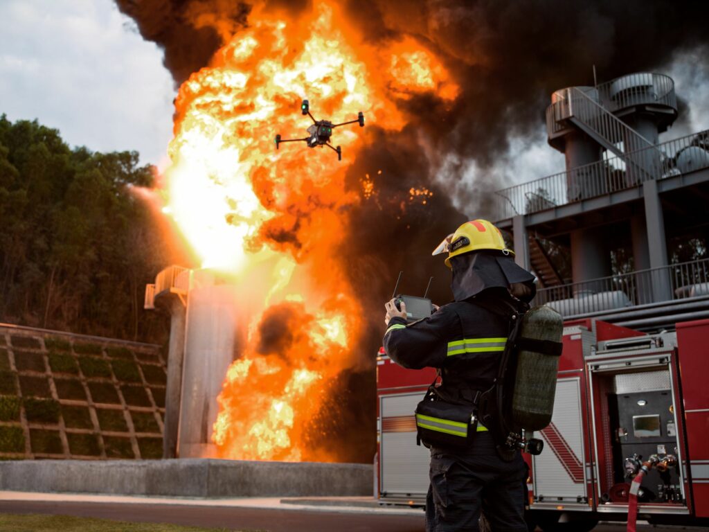
Disaster Management: Every single passing second feels like an eternity… Every split second could mean ‘Life or Death’ situation… Moreover, in disaster situations, first responders often bear the same life-threatening risks as the victims themselves; There is a need to save the lives of people caught in the heat of the disaster while also ensuring the safety of people involved in the rescue mission. We need an easy, affordable, quick, efficient and effective solution to aid disaster management, or simply put, we need DRONES!
Police Drones: How they are crucial for Public Safety and Security?

The unpredictability of the Public Safety and Security sector has tested the roles and responsibilities of Law Enforcement Agencies, leading to the massive adoption of technologies to assist them in their operations. And recently, one type of technology has had a bigger impact than the previous few put together – Drones! Did you know that the World Police Summit 2023 would have an entire conference devoted only to “Drones”? From frontline operations to remote surveillance missions, drones and their powerful payload capabilities have been invaluable to the Police force and other law enforcement agencies. Let’s learn about how police drones in the region have been keeping all of us safe and sound!
Police Drones – How are they crucial for Public Safety and Security?

The unpredictability of the Public Safety and Security sector has tested the roles and responsibilities of Law Enforcement Agencies, leading to the massive adoption of technologies to assist them in their operations. And recently, one type of technology has had a bigger impact than the previous few put together – Drones! Did you know that the World Police Submit 2023 would have an entire conference devoted only to “Drones”? From frontline operations to remote surveillance missions, drones and their powerful payload capabilities have been invaluable to the Police force and other law enforcement agencies. Let’s learn about how police drones in the region have been keeping all of us safe and sound!
Precision Farming’s New Tool – The Mavic 3 Multispectral
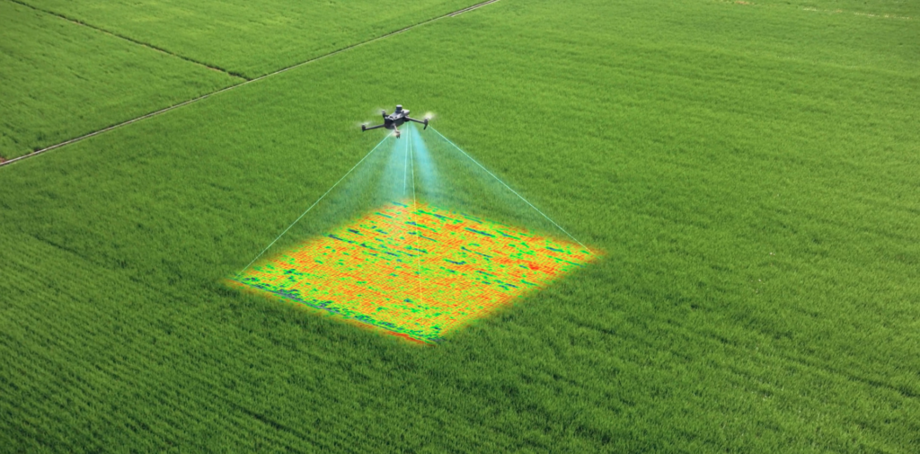
The new Mavic 3 Multispectral Drone is a game-changer for farmers, agricultural workers and environmental scientists. Equipped with a special camera that can see in the near-infrared spectrum, allowing users to see things that they wouldn’t be able to see with the naked eye. The multispectral camera can be used to spot crop stress, identify pest infestations, and track water levels. With this drone, farmers will be able to improve their yields and decrease their costs.
Bringing the Mavic 3 Enterprise Series to the UAE
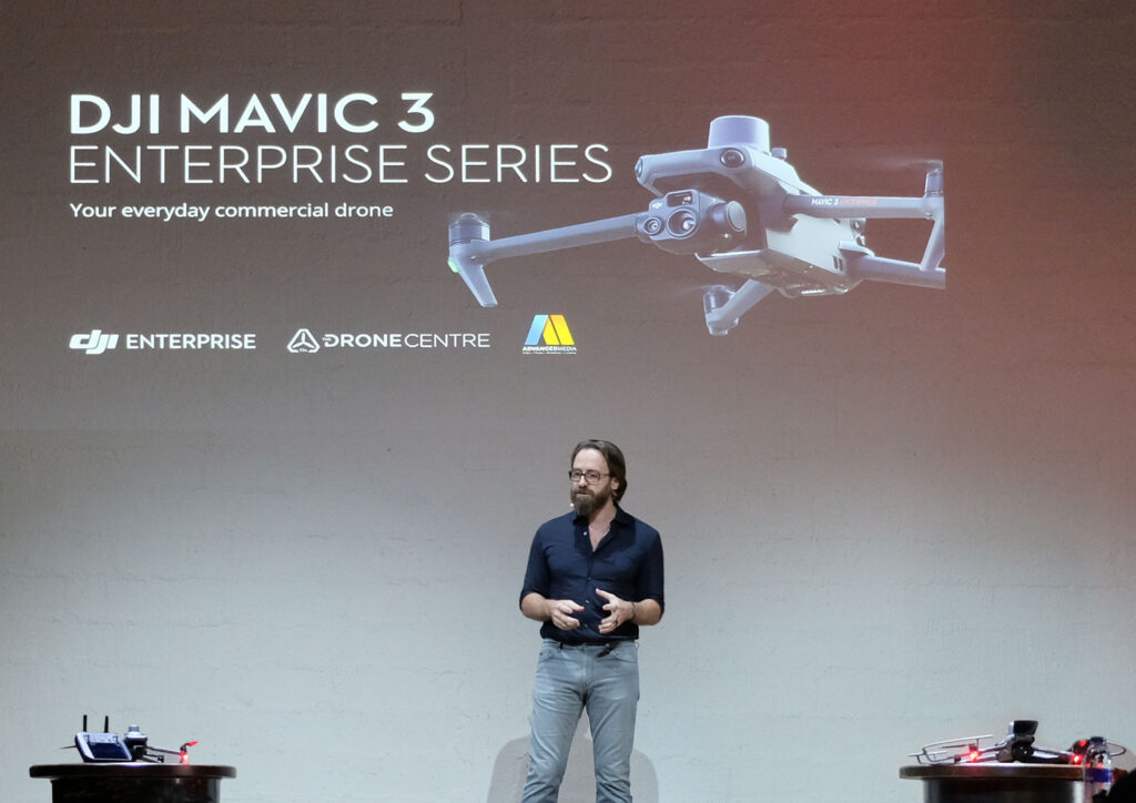
The Drone Centre, the Middle East platform for DJI, the world’s leading producer of unmanned aerial systems (UAS) launches the new DJI Enterprise drone series, the Mavic 3 Enterprise Series. The Mavic 3 Enterprise is DJI’s newest and most compact drone solution, designed specifically for commercial and industrial applications. With a powerful and portable design, the Mavic 3 Enterprise is capable of flying in the most challenging environments and can be used for a wide range of applications such as search and rescue, inspection and surveying, mapping and surveying, and more.
Lightweight, Compact & Powerful; The all-new DJI Mavic 3 Enterprise Series
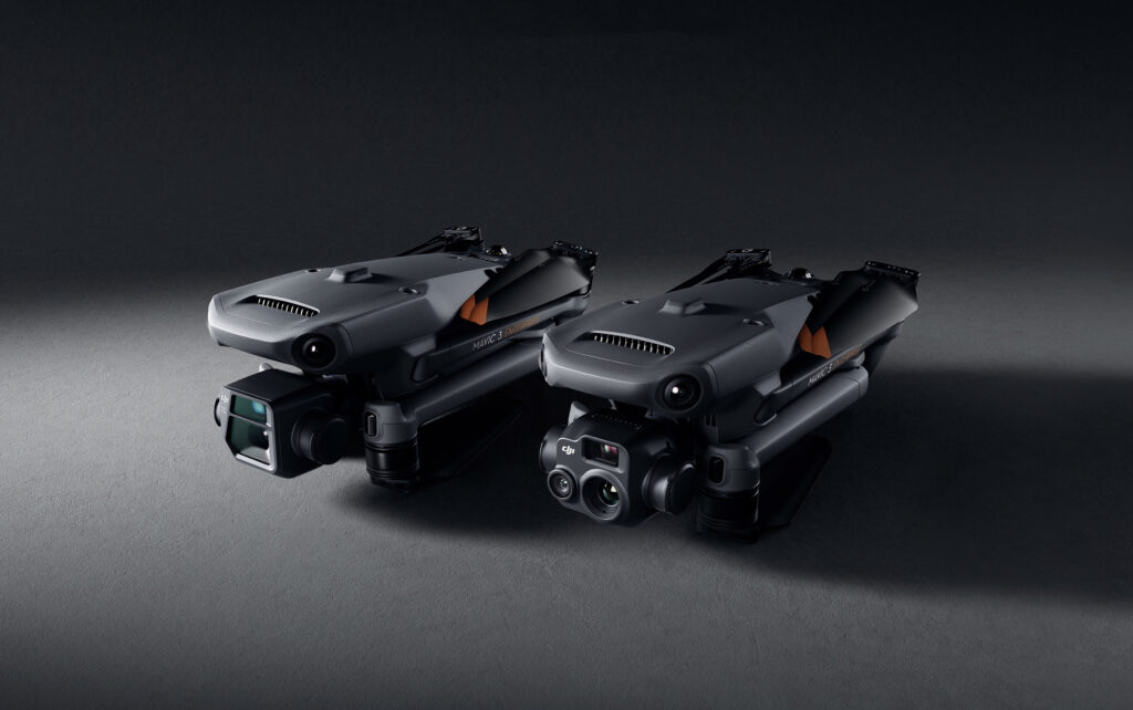
The latest addition to DJI’s Enterprise Drones – the DJI Mavic 3 Enterprise Series is trending! DJI has introduced the all-new Mavic 3 Enterprise Series – DJI Mavic 3E and DJI Mavic 3T – setting new benchmarks for lightweight, compact and powerful commercial drone operations. These highly streamlined and compact series of drones can be handled with a single hand and can be deployed at a moment’s notice– translating to quicker and better-informed decisions during critical missions. Moreover, the Mavic 3 Enterprise drones come with the latest obstacle-sensing technology, support for network RTK, a full software suite, top-tier data security features to keep your data safe during sensitive flights and significantly more. So apparently, we have a lot to explore about this invaluable addition to your drone fleet. Likewise, we’ll also see how the DJI Mavic 3 Enterprise Series perform in comparison to the DJI Phantom 4 RTK and the DJI M300 RTK-P1 combo.
DJI Drones for the Construction Sector
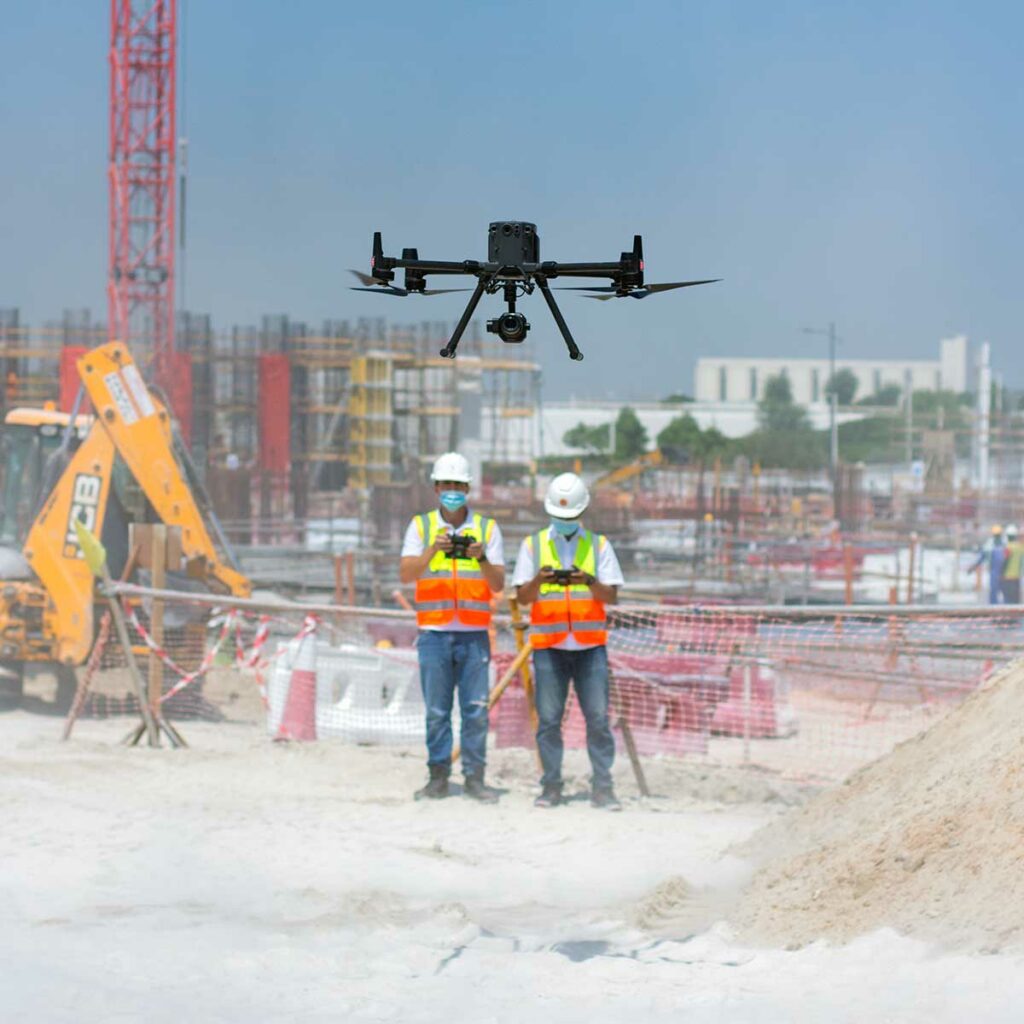
Have you ever felt a significant void in the construction sector? A report published by AutoDesk & FMI reported that insufficient project data and miscommunication are the cause of 52% of reworks on construction sites. These reworks translate to severe delays in the process, higher cost, labour, and significantly more. Apparently, comprehensive real-time monitoring is the need of the hour, and right now, drone-powered solutions are the only way to achieve this. Drone solutions can help us in every single step in the construction process – be it mapping the construction plot, construction progress monitoring, asset inspection and more. As per Allied Market Research, the construction drone market is expected to reach nearly $12 billion by 2027. Wondering why? The PwC report states that implementing drones in your construction efforts makes a crucial difference in managing costs, controlling risks, increasing safety and influencing outcomes.
TDLAS Technology for gas leak detection; Introducing DJI Zenmuse U10

Meet the all-new DJI Zenmuse U10, a gas detection payload that uses a Tunable Diode Laser Absorption Spectroscopy (TDLAS) technology to detect methane gas up to 100 m away. U10 is a culmination of robust visual and laser gas-detection sensors that allow businesses to be cost-effective by resolving multiple jobs simultaneously. Intrigued? Let us learn more about this invaluable addition to your Oil and Gas operations. As this article progresses, we’ll learn how the U10 helps us to perform inspections Safer, Faster, more Efficient, and way more Cost-effective.