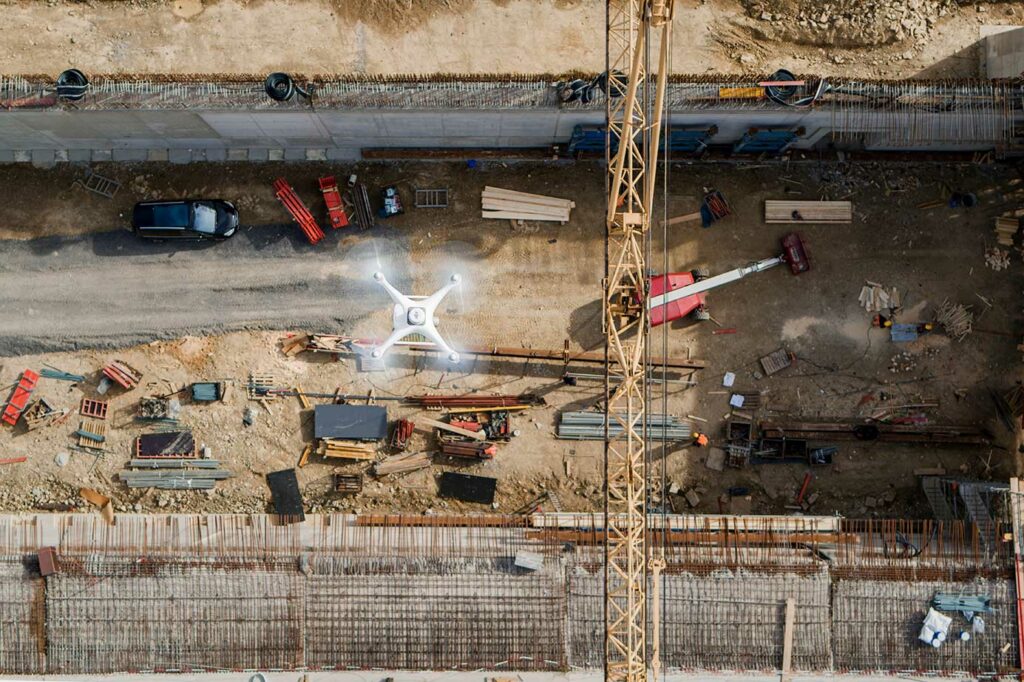
DJI Drones for the Construction Sector
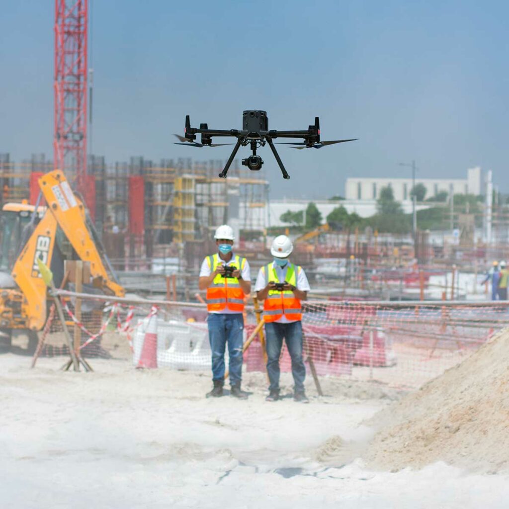
Have you ever felt a significant void in the construction sector? A report published by AutoDesk & FMI reported that insufficient project data and miscommunication are the cause of 52% of reworks on construction sites. These reworks translate to severe delays in the process, higher cost, labour, and significantly more. Apparently, comprehensive real-time monitoring is the need of the hour, and right now, drone-powered solutions are the only way to achieve this. Drone solutions can help us in every single step in the construction process – be it mapping the construction plot, construction progress monitoring, asset inspection and more. As per Allied Market Research, the construction drone market is expected to reach nearly $12 billion by 2027. Wondering why? The PwC report states that implementing drones in your construction efforts makes a crucial difference in managing costs, controlling risks, increasing safety and influencing outcomes.
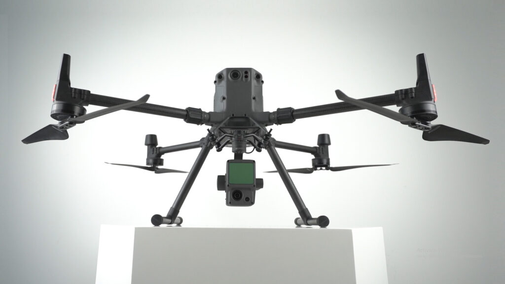
DJI Zenmuse H20T; an integration of powerful multi-sensors
DJI Zenmuse H20T is an incredible payload from the H20 series, and is popularly known for its thermal capabilities. First, let’s get the basics right. The ‘H’ stands for its ‘Hybrid’ nature, ’20’ denotes its 20MP zoom camera and ‘T’ stands for Thermal camera. Well, H20T isn’t just that; what if I say it incorporates the capacities of DJI’s best industrial drone platforms? Let’s explore more about the DJI Zenmuse H20T.
DJI Zenmuse H20N v/s H20T; What’s the best?

Let’s talk about DJI’s Zenmuse H20 Series – DJI’s first hybrid sensor solution. The payloads in the H20 series (DJI Zenmuse H20N and DJI Zenmuse H20T) share multiple similarities but have certain variations too. And the significant difference between them lies in the slight change in the labelling at the end – T or N. T for ‘Thermal’ and N for ‘Night Vision’; this is where the major difference lies, both cost-wise and function-wise. Pricing-wise, the H20N is a bit costlier than its thermal counterpart. Even though these payloads are meant for specific industrial needs, you might have this natural tendency to compare them. ‘What’s the best?’ is a question we can’t help. Don’t worry; this article is for you. Let’s explore DJI Zenmuse H20N v/s H20T; here, we will discuss about the headline innovations, similarities and differences of these incredible payloads in the H20 series.
LiDAR or Photogrammetry – Which one is better?
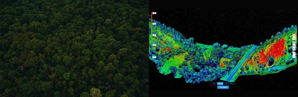
Drones make operations Safer, Efficient, Accurate, Quick, and way more Cost-effective compared to traditional practices. Drones are becoming increasingly popular in Surveying and Mapping, and this adoption can only be attributed to the huge array of benefits that come along with it. Drones allow you to conduct operations with a fraction of the workforce while improving efficiency and accuracy; moreover, drone-powered surveys and mapping are 75%-80% quicker than terrestrial measurement while giving you high precision and improved safety. For surveying and mapping professionals, LiDAR and Photogrammetry data-capturing techniques have been a part of the process. Now the only question that is troubling almost everyone – from amateurs to experienced drone professionals is – ‘Which one is better – Lidar or Photogrammetry?’ and naturally, the next question is – ‘DJI Zenmuse L1 or DJI Zenmuse P1? So let’s get into this dilemma.
DJI Zenmuse P1; Sub-centimeter GSD when Surveying & Mapping
Let’s talk payloads – Drone professional’s favourite photogrammetry tool, the DJI Zenmuse P1.
Did you know that P1 is DJI’s largest image sensor with the highest resolution? The Phantom 4 RTK – the closest competitor, has a 20MP sensor, which is 7.5 times smaller than the DJI Zemuse P1. There are a lot of exciting features to explore on P1, including its full-frame sensor, interchangeable lenses, the Smart Oblique Capture function and more. We hope this article will guide you to make better-informed decisions.
DJI Zenmuse L1; LiDAR Survey Made Easy
For a multitude of reasons, DJI’s first Livox LiDAR payload — the Zenmuse L1, is gaining a lot of traction among drone professionals. First of all, the DJI Zenmuse L1 incorporates the powers of both laser and visible light; this payload can simultaneously capture both LiDAR and Photogrammetry data. L1 is well known for capturing ‘accuracy’ by integrating a Livox LiDAR module, a high-accuracy IMU, a survey-grade camera, and additionally, it comes with a 3-axis stabilized gimbal. Well, not just that, there is a lot more to explore on this unparalleled player in the Drone-based solutions!
Confessions of a Drone Professional: Why We Love the M300 RTK
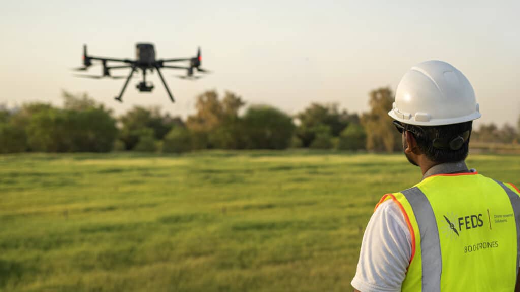
There is no doubt that DJI’s Matrice 300 RTK has set a new standard for the commercial drone industry. With its array of purposeful and powerful features combined with a robust build, you’d be hard-pressed to find better. However, this isn’t an article where we discuss the features of the M300 RTK — there are plenty of those already; in this article, we will be discussing why the pilots at FEDS-drone Powered Solutions love working with this powerful drone system.
Surveying and Mapping Made Easy with the DJI M300 RTK
The DJI M300 RTK excels at capturing data quickly and efficiently from different points and perspectives that are otherwise inaccessible to humans.
Construction Progress Monitoring: How can I improve my Business?
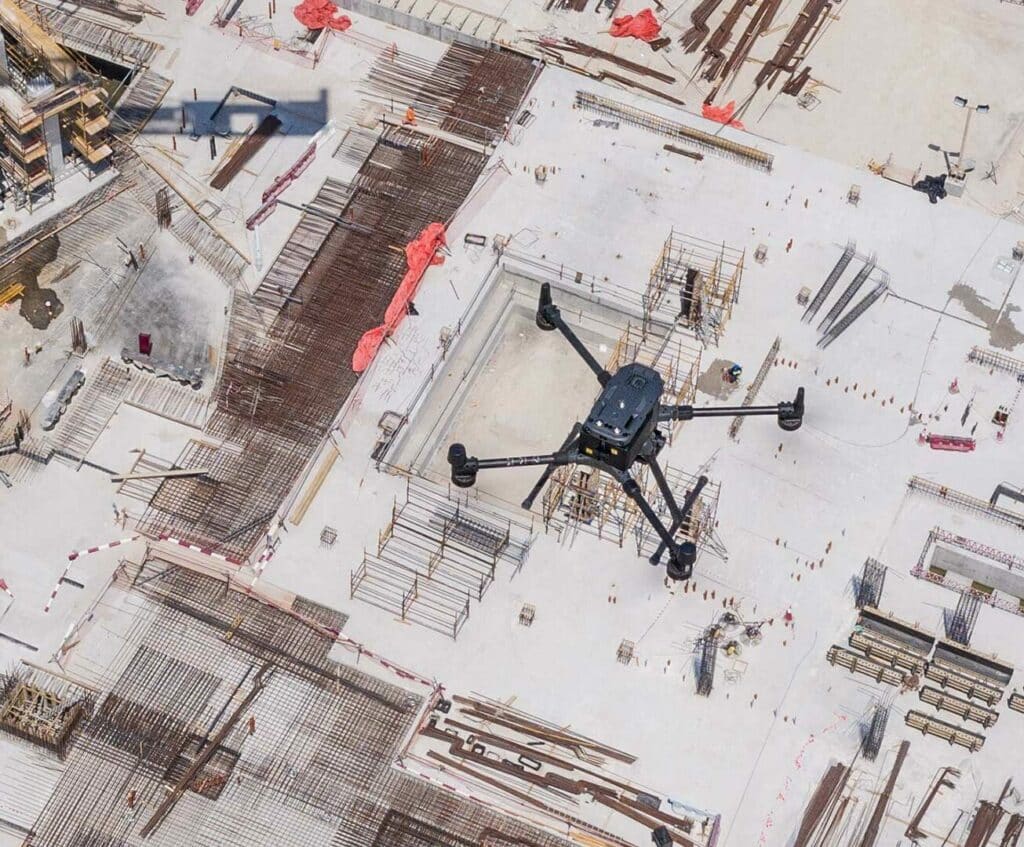
Rework in construction typically costs about 5% of the overall contract value. And the time overruns are worse, at roughly 7.1% of total work hours. These overruns impact relationships between trade contractors, general contractors, and owners, which makes it crucial to reduce and avoid rework. Drone and Crane Camera progress monitoring can reduce the rework by 20-25% by bringing real-time as-build data to help contractors identify a conflict in project designs and avoid unnecessary rework.
DJI Phantom 4 RTK Mapping: Visionary Intelligence, Elevated Accuracy
DJI Phantom 4 RTK is a godsend for surveyors working in cities or on small to medium-sized fields. The drone’s small frame, combined with its simple workflow, makes it incredibly simple to integrate into your workflow.
Come join in the conversation with industry veteran Scott Henderson Head of Sales at The Drone Centre, as he explores DJI’s Phantom 4RTK and how you can use it to monitor your construction sites.