Surveying and Mapping Made Easy with the DJI M300 RTK
The DJI M300 RTK excels at capturing data quickly and efficiently from different points and perspectives that are otherwise inaccessible to humans.
Share This Post
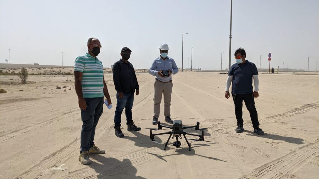
We demonstrated to noon Amana how the DJI M300 RTK enables easy data collection without the hazards of terrain, dust, or complex environments through accurate aerial surveys.
Thus, the Matrice 300 RTK eliminates inefficiencies and hazards and gives rise to surveying excellence.
Operating the M-300 RTK
Traditional surveying methods necessitate meticulous measurement, preparation, and planning, whereas drones can gather all of this information in a much shorter amount of time.
By enabling faster survey turnaround times, surveys can be conducted, and data delivered more cost-effectively. Drone data can be displayed in a variety of ways, making it useful in a wide range of fields. Orthomosaic, thermal, and multispectral maps, as well as point clouds and 3D reality captures.
Zoomed in image showcaseing the Zenmuse P1's capabilities
One of the challenges of surveying and mapping in the desert is the sand. Conducting surveys and obtaining accurate results can be difficult in the desert; the sand acts as one big homogeneous surface, and as a result, you don’t get enough tie-points to generate dense point clouds.
Desert dunes that show a distinct lack of texture
This is when the 45-megapixel full-frame sensor comes in. The Zenmuse P1, when paired with the M-300 RTK, is a game-changer for aerial surveys. The P1’s sensor is powerful enough to capture texture even when the subject is uniform and smooth desert sand.
Using DJI's Zenmuse P1 we can now capture the previously invisible textures
This POC with noon Amana demonstrates how a robust platform like the M300 RTK can significantly improve surveying and mapping workflow. Surveying this area with a TLS (Terrestrial Laser Scanner) would be 10 times slower while yielding inferior data.
If you’re looking to conduct surveys in challenging areas, you’d be hard-pressed to find a more cost-effective solution than the DJI M300 RTK and Zenmuse P1.