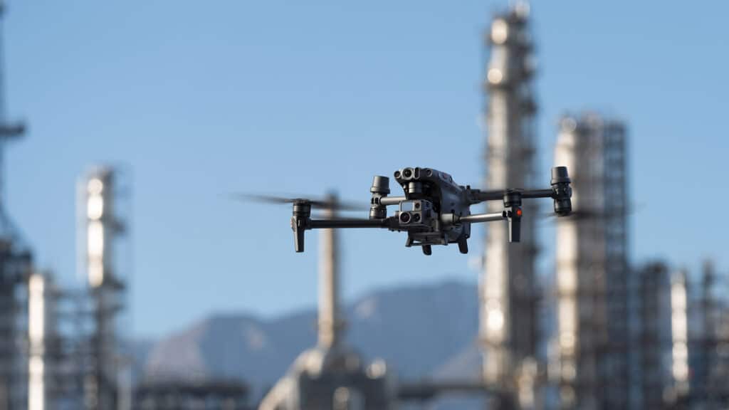
DJI Drones for Oil and Gas Sector

The Global Market for drones in the Oil and Gas sector is expected to reach 16.72 billion USD by 2025, with a Compound Annual Growth Rate of 35.24% from 2019. Almost all the major players in the Oil and Gas sectors have completely migrated to drone-powered solutions. For instance, BP, one of the world’s seven oil and gas “supermajors”, is one of the early adopters of drones in their operations. Drones for Oil and Gas sector is a game changer; they make your operations Safer, Faster, Cost-effective and way more Efficient. Are you worried about the pain points in your Oil and Gas operations? Well, DJI manufactures “solutions” rather than products. This article talks about how DJI drones empower you with the right solution against each pain point in your Oil and Gas operations. Hopefully, you’ll get to know it better as the article progresses.
7 Reasons Why You Should Be Talking About the DJI M30
Nothing gets us more excited than a good drone— and we haven’t been this excited in a long time. Enterprise level drones are extremely powerful but logging them around has always been a point of contention. Not anymore, not with the M30 series. But we’re getting ahead of ourselves. Starting from the top, here are the reasons why we think you should be talking about the DJI M30 series.
DJI Drones for Public Safety
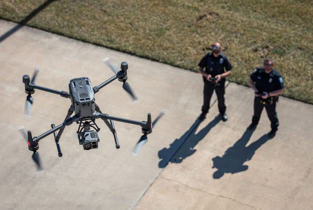
“Drones are one of the busiest assets in our organisation,” says Steve Mclinden, Group Manager, Mid and West Wales Fire and Rescue Services. A market survey reveals that DJI dominates the public safety sector, maintaining more than 90% of the market share. DJI is known to be the first responder to people’s needs. In the first-ever DJI product launch in the Middle East, Jony Ji, DJI Enterprise Sales Manager for the Middle East region, reiterated how DJI enterprise drones are designed upon the invaluable inputs from drone experts and enthusiasts.
DJI Zenmuse H20T; an integration of powerful multi-sensors
DJI Zenmuse H20T is an incredible payload from the H20 series, and is popularly known for its thermal capabilities. First, let’s get the basics right. The ‘H’ stands for its ‘Hybrid’ nature, ’20’ denotes its 20MP zoom camera and ‘T’ stands for Thermal camera. Well, H20T isn’t just that; what if I say it incorporates the capacities of DJI’s best industrial drone platforms? Let’s explore more about the DJI Zenmuse H20T.
TDC hosts the first-ever DJI Enterprise Product Launch in the Middle East

Dubai, UAE: On 2nd August 2022, the Middle East witnessed its first-ever DJI Enterprise Product Launch. The Master Dealer of DJI Enterprise in the Middle East – The Drone Centre officially announced the launch of two DJI Enterprise solutions in the region – the DJI M30 Series and DJI Zenmuse H20N. It was an incredibly productive day that heard proactive conversations and actionable takeaways that the present and future would appreciate. The event saw active participation of 50+ attendees including professionals from both government entities and private sector from various industries – energy & utilities, telecommunication, and AEC & survey – to name a few.
DJI Zenmuse H20N; a payload beyond Night Vision

Low-light scenarios usually spell disaster for camera sensors. But thanks to the all-new DJI Zenmuse H2ON – the latest addition to DJI’s first hybrid sensor solution. H20N is a payload exclusive for night missions, equipped with double-efficient starlight sensors. We can’t wait to see how M300 users are going to leverage this tool in their public safety and security applications. Let’s get to know H20N better.
DJI Zenmuse H20N v/s H20T; What’s the best?

Let’s talk about DJI’s Zenmuse H20 Series – DJI’s first hybrid sensor solution. The payloads in the H20 series (DJI Zenmuse H20N and DJI Zenmuse H20T) share multiple similarities but have certain variations too. And the significant difference between them lies in the slight change in the labelling at the end – T or N. T for ‘Thermal’ and N for ‘Night Vision’; this is where the major difference lies, both cost-wise and function-wise. Pricing-wise, the H20N is a bit costlier than its thermal counterpart. Even though these payloads are meant for specific industrial needs, you might have this natural tendency to compare them. ‘What’s the best?’ is a question we can’t help. Don’t worry; this article is for you. Let’s explore DJI Zenmuse H20N v/s H20T; here, we will discuss about the headline innovations, similarities and differences of these incredible payloads in the H20 series.
LiDAR or Photogrammetry – Which one is better?
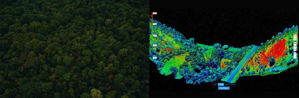
Drones make operations Safer, Efficient, Accurate, Quick, and way more Cost-effective compared to traditional practices. Drones are becoming increasingly popular in Surveying and Mapping, and this adoption can only be attributed to the huge array of benefits that come along with it. Drones allow you to conduct operations with a fraction of the workforce while improving efficiency and accuracy; moreover, drone-powered surveys and mapping are 75%-80% quicker than terrestrial measurement while giving you high precision and improved safety. For surveying and mapping professionals, LiDAR and Photogrammetry data-capturing techniques have been a part of the process. Now the only question that is troubling almost everyone – from amateurs to experienced drone professionals is – ‘Which one is better – Lidar or Photogrammetry?’ and naturally, the next question is – ‘DJI Zenmuse L1 or DJI Zenmuse P1? So let’s get into this dilemma.
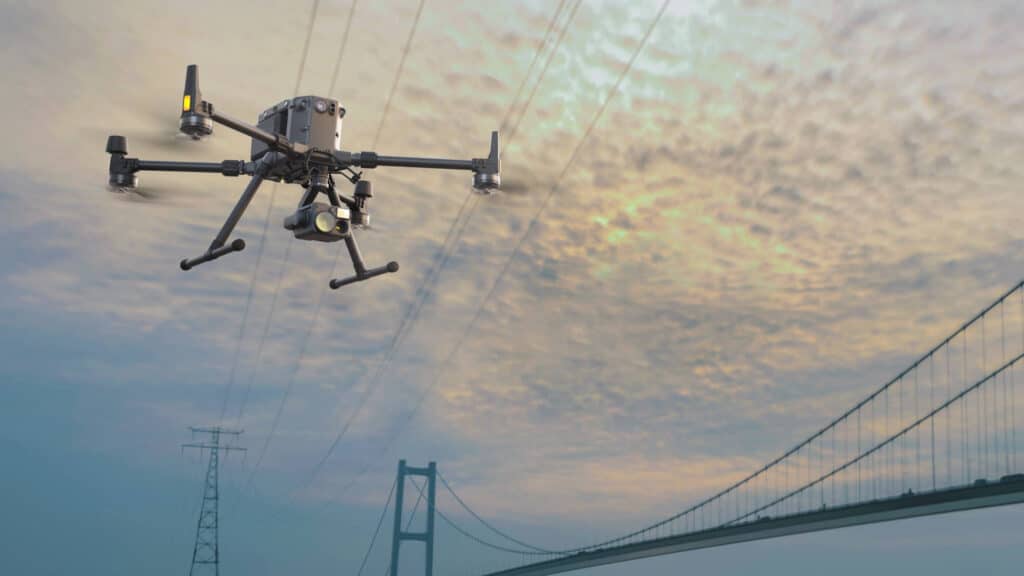
How are DJI Drones Shaping the Future of Telecom Inspections?

The Telecom industry is an ever-evolving space, and so are the challenges associated with its operations and growth – managing vast, complex and remote infrastructures located in hard-to-reach and dangerous terrain is a real challenge. Amid these obstacles, telecoms need to keep their equipment sound and safe while also ensuring the safety of their inspectors. Wondering “how to effectively tackle these challenges”? Let’s find out how drones address these challenges to make the inspection process safer, faster and more effective. Likewise, this article discusses why DJI M3OO RTK is particularly the best player in Telecom Inspections.
DJI Zenmuse P1; Sub-centimeter GSD when Surveying & Mapping
Let’s talk payloads – Drone professional’s favourite photogrammetry tool, the DJI Zenmuse P1.
Did you know that P1 is DJI’s largest image sensor with the highest resolution? The Phantom 4 RTK – the closest competitor, has a 20MP sensor, which is 7.5 times smaller than the DJI Zemuse P1. There are a lot of exciting features to explore on P1, including its full-frame sensor, interchangeable lenses, the Smart Oblique Capture function and more. We hope this article will guide you to make better-informed decisions.