Emlid Reach RS2 GNSS Receiver – Too Good to Be True? Interview with a Professional Surveyor & GNSS Expert

GNSS receivers are one of the most vital tools at a surveyor’s disposal. They speed up surveys and provide much-needed accuracy to the data. So as a firm that conducts many surveys, we can never really have enough GNSS receivers, but this posed a challenge— most industry-leading GNSS receivers are pretty expensive. The price of these receivers can be rationalized, they do provide accuracy up to the mm, but when you’re doing land parcel surveys, earthwork etc., you don’t really need this high accuracy. To address this, the minds at Emlid came out with the Emlid Reach RS2, a multi-band RTK GNSS receiver.
Emergency Response Drones: Saving Lives, Improving Response Times
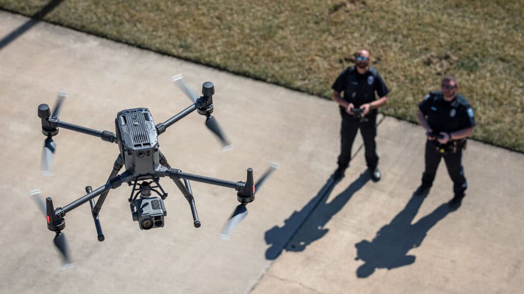
In an urgent response situation, the team and authorities are working against the clock. Traveling to the incident site, establishing situational awareness, and requesting additional resources all take time- precious time that can save lives. While traditional teams have to deal with road conditions, distance, and longer deployment times, drones do not. Emergency Response Drones are life savers. Emergency response teams are now leveraging drones to save lives, improve response times and optimize resource allocation.
Drone Flight Management Software Spotlight: senseFly eMotion

A robust drone flight management system can make or break your operations— often making the difference-making complicated missions painless and efficient. Let’s take a look at sensefly eMotion flight management software. In this article, we talk about our favorite features and what we’re excited for in the new update.
What are the benefits of Spraying Drones? Exploring DJI Agras
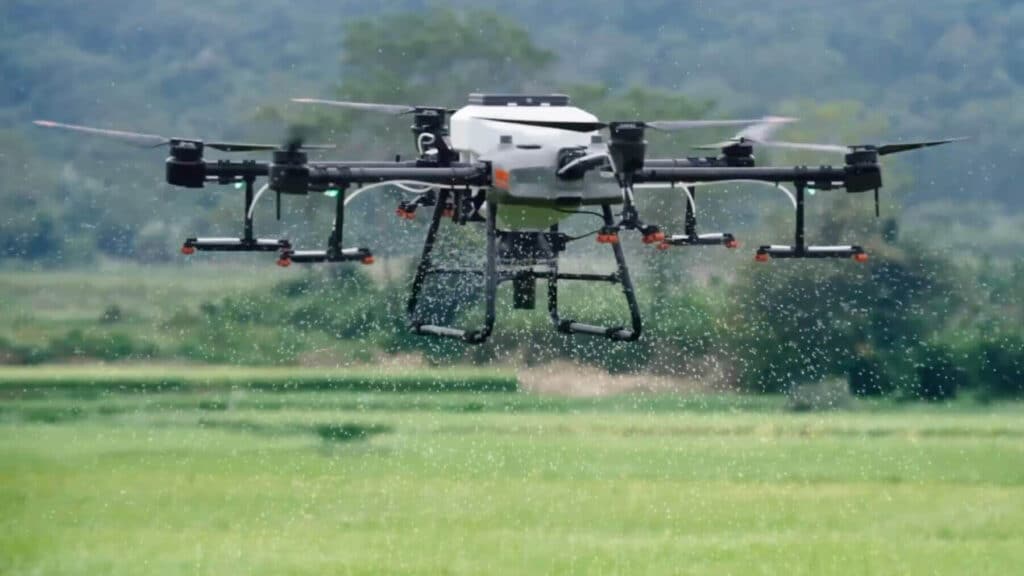
Remote sensing drones remove the guesswork from agriculture. They provide you with precise knowledge of your crops. You can then use this data or knowledge to allocate resources efficiently. Drones are the favored tool to obtain this data, but drones’ lesser-known application is the ability to act on this data. These drones are known as ‘spraying drones’ or agricultural drones. Let’s explore the DJI Agras.
FEDS Partners with Skycatch
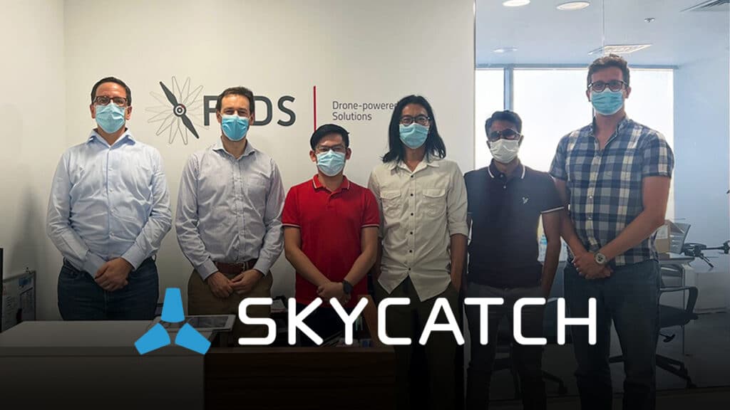
Skycatch is proud to announce a new reselling agreement with FEDS – The Drone Center for the Middle East.
Active since 2014, FEDS – The Drone Center is an established and UAV-focused company in the Middle East, as well as a DCAA Certified Training Centre. FEDS – The Drone Center provides a wealth of knowledge both from a product and market perspective.
Smarter, Safer & More Powerful – Exploring DJI Mavic 3
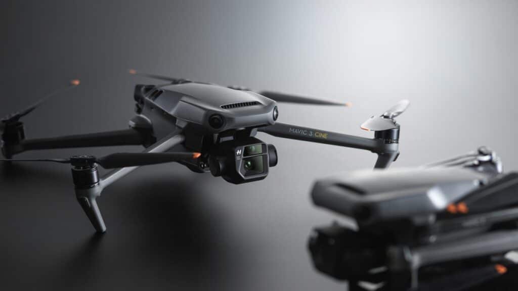
The much anticipated Mavic 3 and Mavic 3 CINE have just launched, and it is positively the prosumer drone to dethrone them all. DJI builds on the features that were great about the Mavic 2 and made it better in the Mavic 3 while somehow maintaining the size and (even reducing) the drone’s weight. So let’s take a look at what makes the DJI Mavic 3 a must-have.
Drone Solar Inspections with DJI M300 RTK
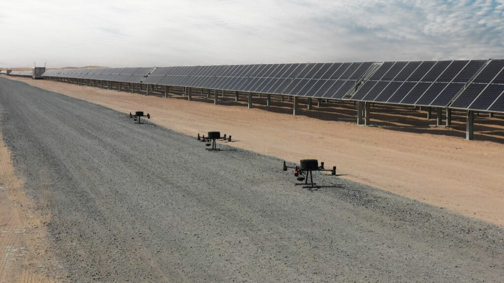
Today’s solar panels are built to last decades- however, longevity and production efficiency are not interlinked. Using three DJI M300 RTKs, each equipped with the Zenmuse H20T, the FEDS Team collected data at the rate of 2,200 panels per day. With the 55min flight time and improved accuracy thanks to RTK, we collected data of the entire solar farm in just five days. Let’s explore on improving operations with Drone Solar Inspections powered by DJI M300 RTK.
Here’s everything you need to know about DJI M300 RTK new firmware update

Its a great year and a half since the M300 RTK has come out. We’ve been quick to upgrade out outdoor inspection fleet to the M-300 to improve our drone inspection reliability and accuracy. So we’re rather excited to find out what further improvements to safety and performance this DJI M300 RTK new firmware update brings.
Surveying and Mapping Made Easy with the DJI M300 RTK
The DJI M300 RTK excels at capturing data quickly and efficiently from different points and perspectives that are otherwise inaccessible to humans.
Transco Trains for Drone-based Powerline Inspection
Inspecting power lines the traditional method is slow, hazardous, and cost-inefficient. Previously, power and utilities companies had to choose between ground patrols and helicopters when conducting inspections. TRANSCO – one of the leading power distribution companies in the UAE now successfully employs drone-based powerline inspection, under the training of FEDS.