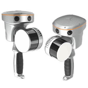
The RS10 integrates GNSS RTK, laser scanning, and visual SLAM technologies into one single platform. This fusion increases the efficiency and accuracy of both indoor and outdoor 3D scanning and surveying tasks. It gives surveyors the ability to work in areas with weak GNSS signals, providing unparalleled flexibility. Designed for surveying, BIM, forestry, power line inspection, underground mapping, and more, the RS10 embodies versatility, making it an essential tool for professionals looking to expand their surveying capabilities.
Combine RTK, laser, and visual SLAM to achieve 5cm absolute accuracy.
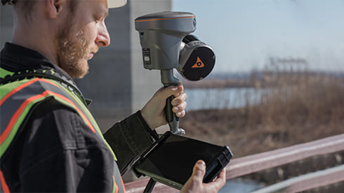
Real-time georeferenced point clouds in the field.
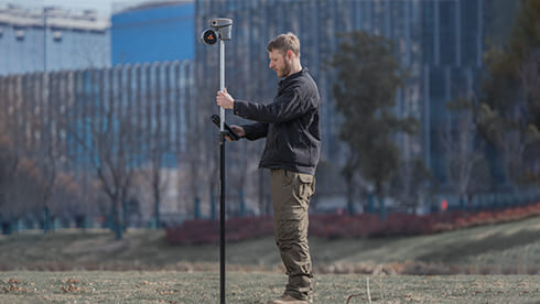
Flexible integration with UAVs, vehicles, and backpacks.
60 minutes per battery with hot-swap capability for uninterrupted operation.
Combine GNSS RTK and SLAM for unparalleled flexibility. The RS10 ensures precise data collection in areas with weak or no GNSS signals, enhancing indoor and outdoor surveying accuracy.
Achieve 5 cm absolute measurement accuracy with the 4th generation GNSS antenna and high-precision LiDAR. The RS10 delivers reliable data for detailed architectural surveys and complex infrastructure projects.
The RS10 creates georeferenced point clouds directly in the field with real-time SLAM capabilities. It provides immediate feedback on collected data, allowing for on-the-fly adjustments to ensure complete coverage.
Eliminate the need for traditional loop closure with integrated GNSS and SLAM technologies to simplify field data collection and reduce project completion time and effort.
Use the RS10 for a wide range of applications, from BIM and forestry to power line inspection and underground mapping. Its versatility makes it an invaluable tool for professionals in various fields.
The RS10 streamlines your workflow with the SmartGo and CoPre software for real-time data visualization and point cloud processing. It supports efficient and accurate data management from collection to modeling.
Operate in challenging environments with the IP64-rated, lightweight RS10. The robust design ensures reliability and ease of use in diverse conditions.
Maintain continuous operation with the hot-swappable lithium battery. The RS10 offers 60 minutes of runtime per battery, allowing for seamless replacement without powering off the unit.
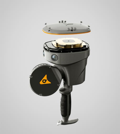
Multi-platform Premium LiDAR
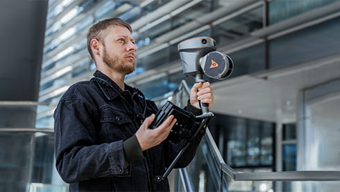
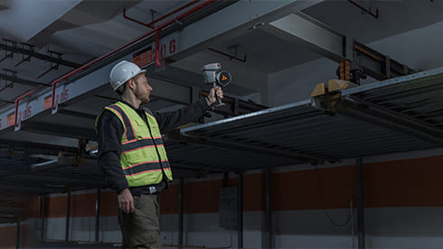
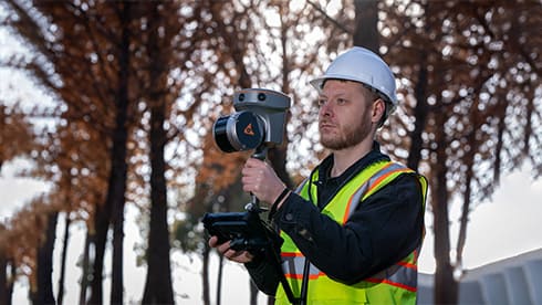
Handheld laser scanners are used for capturing detailed 3D measurements and models. The RS10 is widely used in surveying, construction, and engineering, building information modeling (BIM), construction verification, industrial inspection, heritage preservation, forensics, and any task requiring accurate 3D spatial data.
Consider factors like scanning range, resolution, portability, ease of use, compatibility with software, and the specific needs of your project to ensure you select the right scanner for your application.
The RS10 already has a built-in GNSS RTK receiver. It can be used alongside total stations, and other surveying equipment. Data from handheld scanners can be integrated into comprehensive surveying workflows for enhanced project outcomes.
The RS10 integrates GNSS RTK, laser scanning, and visual SLAM, providing precise data collection even in areas with weak or no GNSS signals.
The RS10 features real-time SLAM mapping and an efficient loop-free workflow, reducing project completion time and effort.
The RS10 uses 4G, Wi-Fi, and Bluetooth® 4.2 for seamless data transmission and communication during field operations.
Get the support you need. From choosing the right drones to getting professional training, our experienced drone consultants ensure that all your needs are met.