The Digital Twin Sustainability Revolution: Integrating Autonomous Drones and AI for High-Fidelity Asset Management
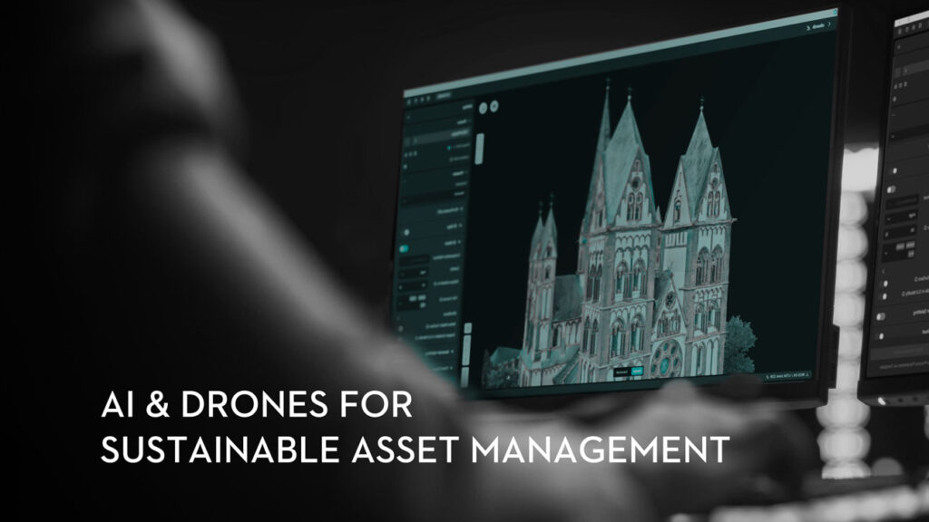
A combination of drone data and AI has given rise to more efficient and sustainable infrastructure management. Through digital twins, organisations are transforming how they approach asset management.
Wider Adoption of Gaussian Splatting with Drone Data Signals a New Era in 3D Reconstruction
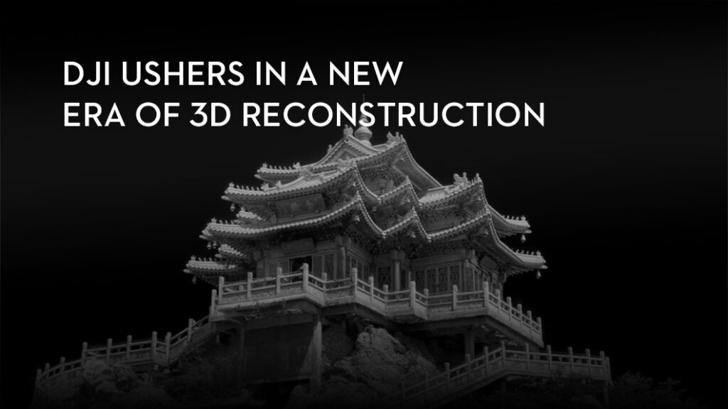
A fundamental change is taking place in the world of 3D reconstruction and digital twin creation. And it moves beyond the familiar polygons and meshes that have defined digital models for decades. This shift, powered by a technique known as 3D Gaussian Splatting, is redefining the standards for speed, realism, and detail in the creation of digital space.
The Drone Centre and Angelswing Partner to Advance Drone Solutions in MENA

We’re excited to announce a new partnership between The Drone Centre (TDC) and Angelswing, aimed at bringing advanced drone-data solutions to the Middle East and North Africa. This collaboration combines TDC’s regional expertise with Angelswing’s powerful platform for digital twins, aerial data, and project insights; helping organisations enhance efficiency, safety, and innovation across their infrastructure projects.
The Drone Centre Partners with AirHub to Bring Smarter Drone Operations to the Region

Drones are already changing the way we work, but there’s one piece that has always been tricky: keeping operations safe, simple, and compliant while scaling up. That’s why we’re genuinely excited to share some big news—The Drone Centre is partnering with AirHub. Together, we’re making it easier for organisations across the Middle East and Africa to manage their drone fleets with confidence.
Everything You Need to Know About the DJI Matrice 400
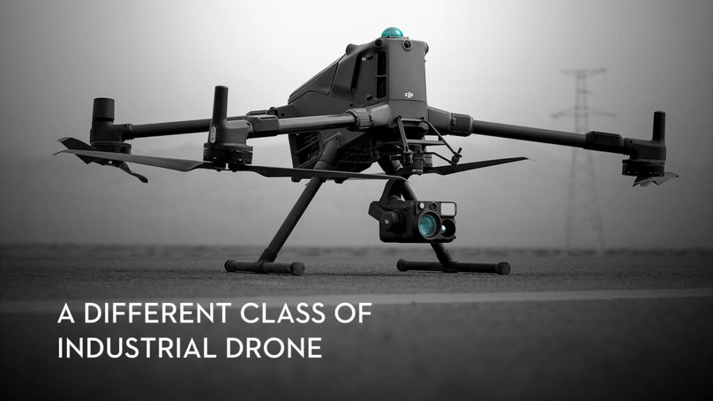
For years, serious enterprise drone operations in the region have been a story of compromise. You had to choose between payload capacity and flight time. You had to operate platforms not built for the heat and fine dust of our region. And you had to constantly manage the risk of flying near complex assets.
Drone Delivery in the UAE: Global Progress and Local Moves Suggest Imminent Reality
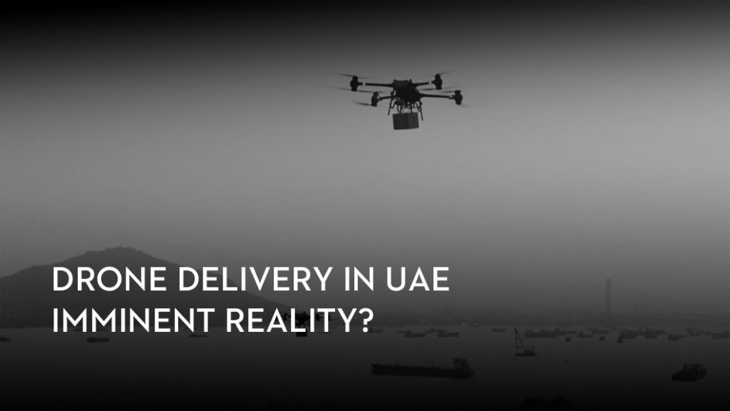
The UAE’s logistics sector is on the verge of a significant operational shift, fueled by rapid advancements in autonomous drone technology. Successful global milestones and promising regional pilot projects indicate that a transformative era for drone-powered goods transportation, especially in last-mile delivery, is just over the horizon.
DJI Matrice 400 Drone Platform is Set to Redefine Operational Boundaries in the MEA Region
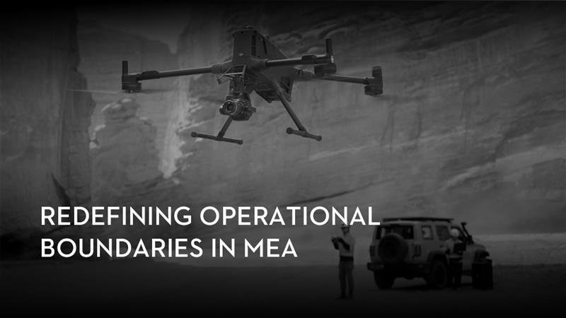
Public safety and energy operations in the Middle East and Africa face unique environmental and geographical challenges. The release of the Matrice 400 – DJI’s new multi payload drone is poised is to extend these operational limits. Its advanced capabilities are built for missions across high temperatures, vast areas, and intricate infrastructure, transforming critical drone use throughout the region.
Newly Launched DJI Payloads Highlight Expanded Capabilities for Drone Operations
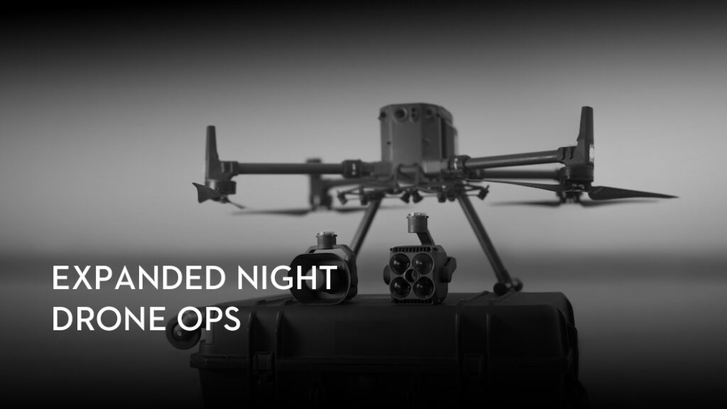
The recently launched enterprise payloads, the Zenmuse S1 and Zenmuse V1, are set to enhance aerial operations during low-light and emergency scenarios. The payloads, launched globally last month, are compatible with DJI’s Matrice 350 RTK and Matrice 300 RTK drone platforms, which are widely adopted across industrial and public sector applications in the UAE and the wider Middle East.
Transform Your Confined Space Inspections with Asio X

Your team’s safety is the priority, yet traditional confined space inspections often place them directly amidst hazardous sites. The Flybotix AsioX was created to resolve this conflict. It is a dedicated tool designed to go where people should not, removing the human risk factor entirely. This drone is engineered for precision in hazardous locations, offering a smarter way to conduct your inspections.
Is the Zenmuse P1 still worth it?

Is the DJI Zenmuse P1 still a worthy investment in today’s fast-evolving drone market? While newer sensors have emerged since its 2020 launch, the P1 continues to be a compelling choice for many photogrammetry professionals.
Let’s explore why the Zenmuse P1 remains a relevant and powerful tool in 2025.