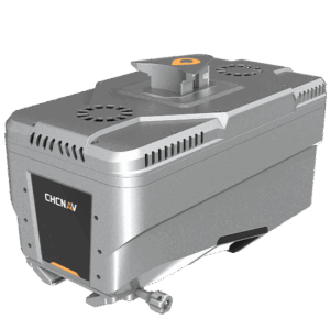
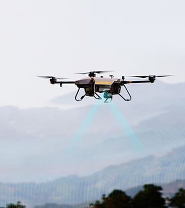
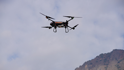
The AlphaAir 15 (AA15) is a lightweight, high-performance airborne LiDAR system designed for large-scale operations where high-density data capture is crucial. With a range of up to 1800 meters and the ability to produce 2 million pulses per second, the AA15 is ideal for mapping and geospatial applications, including corridor mapping, urban planning, and vegetation analysis. Its compact design allows for easy integration with UAVs, small aircraft, and helicopters.
15 mm linear accuracy at 150 meters.
Up to 16 returns per pulse for vegetation penetration.
Easy integration with UAVs, aircraft and helicopters.
Multiple camera types for high-resolution data fusion.
The AA15 delivers 15 mm linear accuracy on long-range scans up to 150 meters using CHCNAV’s patented tilted-prism technology. Its precision ensures reliable data for complex projects, such as corridor mapping, where high-density point clouds are essential.
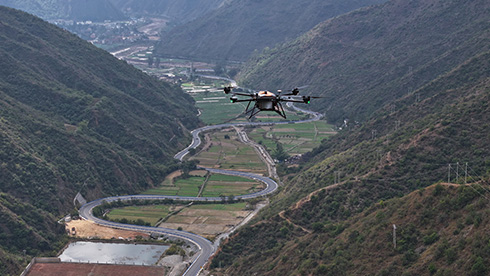
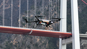
With a maximum range of 1800 meters and a flying height of up to 700 meters, the AA15 is capable of large-scale area coverage with minimal point loss for corridor mapping applications such as highways, railroads, and pipeline inspections.
The AA15 excels in penetrating dense vegetation with its advanced multi-target capability, supporting up to 16 returns per laser pulse. It enables the detection of more ground points, ensuring comprehensive data collection in forested areas and improving the accuracy of terrain models.
The AA15’s lightweight design (2.5 kg) and CHCNAV’s unified AlphaPort interface allow for quick integration with various airborne platforms, including UAVs, small aircraft, and helicopters.
Capturing 2 million points per second, the AA15 is perfect for applications requiring high-density point clouds, such as power line inspections, road surveys, and urban mapping.
The AA15 supports a range of external cameras, including CHCNAV’s 45 MP and 61 MP full-frame calibrated cameras and a 130 MP half-frame oblique camera. The integration of high-resolution imagery with LiDAR data enhances the quality of 3D models and texture mapping.
The AA15 is part of CHCNAV’s complete airborne mapping solution, which includes the SmartGo app for automated reality capture and mission monitoring, and CoPre and CoProcess software for streamlined post-processing and feature extraction.
Designed to withstand challenging environments, the AA15 operates in temperatures ranging from -20°C to +50°C and is IP64-rated for dust and water resistance. Its robust construction ensures reliable performance in a variety of field conditions.
Premium Airborne LiDAR Solution
Premium Airborne LiDAR Solution
Professional Airborne LiDAR+RGB System
–
Yes, the AA15’s lightweight design and CHCNAV Alphaport interface allow for quick integration with UAVs, RPAS, manned aircraft, and helicopters.
The AA15 has a maximum range of 1800 meters, making it suitable for large-scale area coverage, including corridor mapping and urban planning.
The AA15 integrates with CHCNAV’s SmartGo app for mission monitoring and CoPre and CoProcess software for post-processing, ensuring efficient data workflows.
The AA15 features 512 GB of onboard storage (with an optional 1 TB upgrade) and supports data transfer via Ethernet, ensuring efficient data management.
Get the support you need. From choosing the right drones to getting professional training, our experienced drone consultants ensure that all your needs are met.