LiDAR or Photogrammetry – Which one is better?
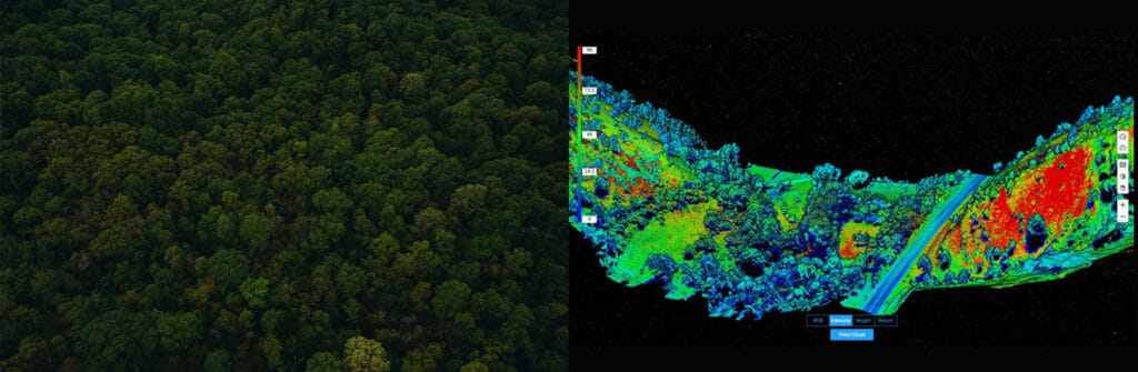
Drones make operations Safer, Efficient, Accurate, Quick, and way more Cost-effective compared to traditional practices. Drones are becoming increasingly popular in Surveying and Mapping, and this adoption can only be attributed to the huge array of benefits that come along with it. Drones allow you to conduct operations with a fraction of the workforce while improving efficiency and accuracy; moreover, drone-powered surveys and mapping are 75%-80% quicker than terrestrial measurement while giving you high precision and improved safety. For surveying and mapping professionals, LiDAR and Photogrammetry data-capturing techniques have been a part of the process. Now the only question that is troubling almost everyone – from amateurs to experienced drone professionals is – ‘Which one is better – Lidar or Photogrammetry?’ and naturally, the next question is – ‘DJI Zenmuse L1 or DJI Zenmuse P1? So let’s get into this dilemma.