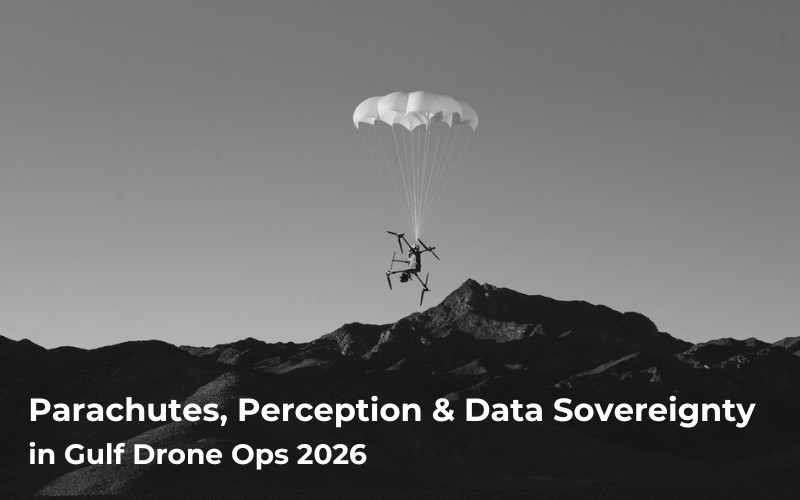
Most multirotor drones aren’t aerodynamic enough to glide. When a motor, an ESC or the attitude control fails at 120 m, the aircraft drops straight down, and whatever is underneath takes the full impact.
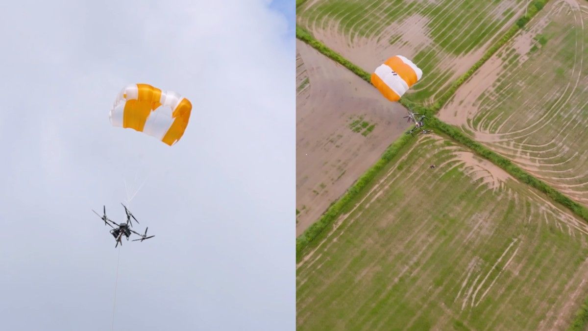
A safety system needs to be dependable, and DJI has designed it to be just that: built-in sensors to detect abnormal altitude shifts independent of the drone’s flight controller, its own power supply, and a termination link to kill motors so lines don’t get cut by propellers. All this so that in case your drone finds itself plummeting, the canopy is pushed clear, the parachute is deployed and descent is controlled to a rate of 5 m/s.
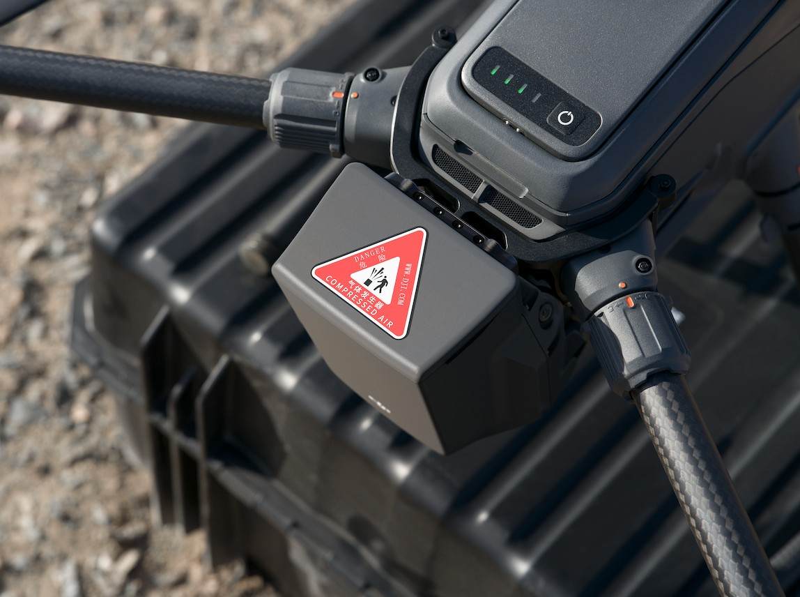
DJI announced the AP100 on 8 July 2026. It mounts at the rear of the aircraft, responds in under 600 ms and brings the M400 down at under 5 m/s from a minimum deployment altitude of 30 m. It carries an IP55 rating to match the aircraft and works from -20°C to 50°C. After deployment, it sounds an audible alarm and flashes a visual one for around an hour, which warns anyone near the landing point and makes the aircraft easier to find.
For operators, the value is in what it unlocks. Attached to an M400 already in the fleet, the AP100 meets C5 and UK5 requirements. DJI lists urban patrol, high-rise façade cleaning and medical or last-mile delivery as the work this opens up. Worth noting that neither the UAE nor Saudi Arabia uses the EASA class-marking system, so those markings carry no direct legal standing with the GCAA or GACA. They still count as third-party evidence of ground risk mitigation, which is exactly what shortens the conversation in a safety case submission.
The costs are small but worth planning around. The 935 g unit takes roughly six minutes off endurance and comes out of the M400’s maximum take-off weight, and the aircraft fits its original case with the parachute fitted. One item belongs in the risk assessment: with the AP100 attached, the M400 automatically disables its downward and backward millimetre-wave radars. You gain ground risk mitigation and lose sensing in two directions.
The other route is to build the recovery system in from the start. DJI’s heavy-lift delivery aircraft carries up to 100 kg in single-battery configuration, reaches roughly 12 km with a 65 kg load on dual batteries and works to 6,000 m in temperatures from -20°C to 40°C.
Its parachute is multi-redundant and sized for deployment at maximum take-off weight, coming down at around 7 m/s. The altitude is the part to plan around: DJI specifies opening at 100 m or above for full performance, and roughly 80 m fully loaded, so route altitude matters for an aircraft that spends much of its profile low. Redundant motors take over if one fails. LiDAR, millimetre-wave radar and a Penta-Vision system handle detection of trees, wires and terrain. The dual-motor winch pays out 30 m of cable at 1.2 m/s with a wireless-charging electric hook, so the aircraft stays clear of the drop zone during release.
Sensing has broadened across the whole drone ecosystem at the moment. The principle is the same at every level. No single sensor type sees everything, so the aircraft carries several and uses them together to further improve safety.
Stereo vision is the base layer. It reads solid, textured objects well in reasonable light, and it has two known weaknesses: darkness and thin obstacles with almost no visual surface. That is why time-of-flight infrared sensors and LiDAR have moved down the range and now appear on consumer and prosumer aircraft rather than enterprise models alone. LiDAR emits its own light, so it keeps working at night where a camera returns nothing usable.
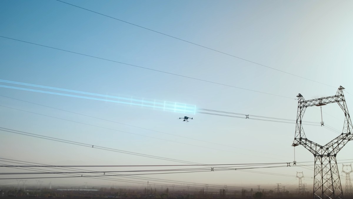
Power lines are the case that pushed the technology hardest. A distribution wire offers almost nothing for a camera to lock onto against a bright sky, and vision-based systems have historically not registered one until the aircraft was nearly on top of it. Millimetre-wave radar and LiDAR solve that from a different direction. The Obstacle Sensing Module has now become the standard for multirotor drone platforms. The Matrice 400 carries a fuller version of the same architecture: omnidirectional binocular vision with surround view, horizontal and upward LiDAR, a downward 3D infrared range sensor and six-direction radar.
What the aircraft does with that information has also changed. Earlier systems stopped when they saw something and waited for the pilot. Current APAS behaviour builds a three-dimensional map of the space and plans a route around the obstacle, so the aircraft carries on with the mission instead of halting mid-line. On enterprise platforms, this extends to recognising what is in front of it, with drones identifying power lines and structures directly and following terrain over uneven ground and tree canopy.
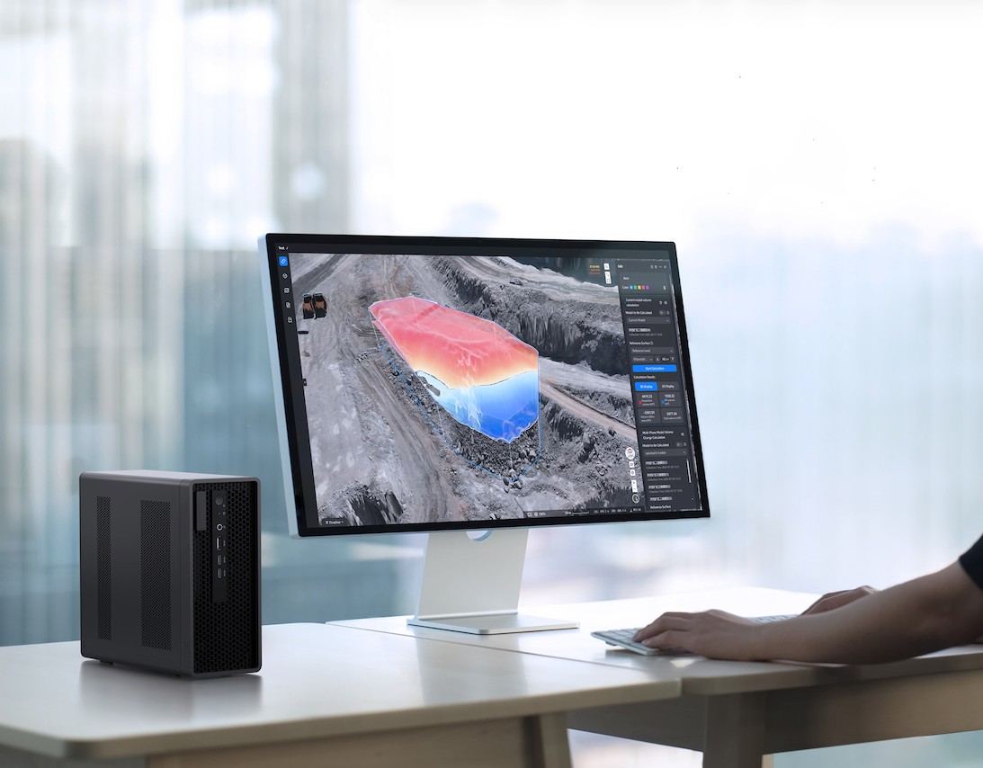
Once fleets move to docked, remotely supervised flying, the question of where the data goes stops being an IT detail. FlightHub 2 On-Premises now supports deployment in private clouds, third-party clouds or local servers, so mission logs, 3D models and live video stay inside the operator’s network.
For teams without server infrastructure, there is the AIO, a 3.01 kg portable that can manage up to 20 aircraft or docks and can be carried to a site.
Underneath that sit controls operators already have. Local Data Mode cuts the app off from the internet entirely. Video transmission uses AES-256 encryption. DJI Pilot 2 asks operators to pick a network security mode at account setup and lets them switch later, and there is a one-tap wipe for device data. In May 2026, an independent cybersecurity assessment by OnDefend reported no critical vulnerabilities, hidden backdoors or unauthorised data transfers in the products it examined.
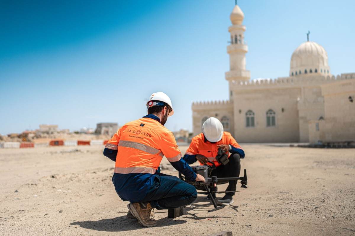
Drone operations across the UAE and Saudi Arabia are coordinated with the relevant civil aviation authorities, and the questions that coordination turns on are the same ones this hardware answers. How is risk to people on the ground managed? What can the aircraft detect, and in what conditions? Where does the captured data sit?
That makes the equipment side less abstract than it looks from the outside. A recovery system, a documented sensing capability and a clear answer on data storage are worth having in place at the point of submission rather than worked out afterwards, particularly for work over built-up areas or across the region’s larger development corridors.
Data residency carries extra weight commercially. Saudi Arabia’s Personal Data Protection Law, enforceable since September 2024, takes the firmer line on keeping personal data in country, while the UAE restricts cross-border transfer rather than banning it outright. Clients across the Gulf increasingly ask where survey and inspection data is stored before a contract is signed, and being able to answer with a local or on-premises arrangement is becoming part of the bid rather than a technical footnote.
The three subjects in this piece are one question asked three ways. The parachute answers what happens when the aircraft stops flying. The sensing suite answers what it could see before that point. The server answers who holds the record afterwards. An operator bidding for work over a populated site in the Gulf will be asked all three, and 2026 is the year the equipment to answer them became straightforward to buy.
That is what makes this a purchasing question rather than a technical one. Three points are worth carrying into the next fleet decision.
None of this sits on the horizon. The parachute is shipping, the sensing is on current airframes, and the server options are available today. Fleets specified this year are the ones that will be flying the region’s work for the rest of the decade, which makes this the year to build the safety case into the purchase rather than around it.
Looking to build a safe and compliant drone fleet for your workflow? Get in touch with us today.
WhatsApp us: +971 52 209 2367