At COP28 in Dubai in December 2023, more than 50 oil and gas companies signed the Oil & Gas Decarbonisation Charter, pledging near-zero upstream methane by 2030. ADNOC’s own commitment goes further: net zero across operations by 2045. Two years on, the regulatory and commercial pressure has only tightened.
Methane is around 80 times more potent than carbon dioxide as a greenhouse gas over a 20-year period. And the oil & gas industry roughly contributes 30% of total methane gas emissions into the environment, with the majority coming from leaks, venting, and incomplete flaring across upstream and midstream infrastructure. Most of those emissions can be prevented.
These emissions have led to stronger regulations:
For an operator selling LNG into European markets, methane intensity is a regulatory threshold that affects market access. For an operator with public net-zero commitments, monthly emissions data is the difference between credible reporting and reputational risk.

A leak from an unmonitored valve or flange can go undetected until the next manual inspection cycle. That is the gap regulators and offtakers are now closing with drone technology.
The traditional methane monitoring has three primary instruments: fixed-point gas sensors at known leak hot-spots, handheld Optical Gas Imaging (OGI) cameras carried by Leak Detection and Repair (LDAR) crews, and periodic helicopter or fixed-wing drone surveys. Each has serious limitations.
Fixed-point sensors only detect leaks at the points where they are installed. The vast majority of an operator’s surface area remains uncovered between inspection cycles.
Handheld OGI surveys are accurate but slow and expensive. A single LDAR technician can only walk a few hundred components per day, making the inspection labour intensive and time inefficient. Annual or semi-annual coverage is the realistic ceiling for most facilities.
Manned aerial surveys cover area quickly but are expensive, weather-dependent, and rarely deliver leak-source localisation accurate enough for repair crews to act on without follow-up groundwork.
The result is a monitoring gap. Operators know they have leaks. They do not know where, when, or at what rate. And the regulatory environment now demands all three.
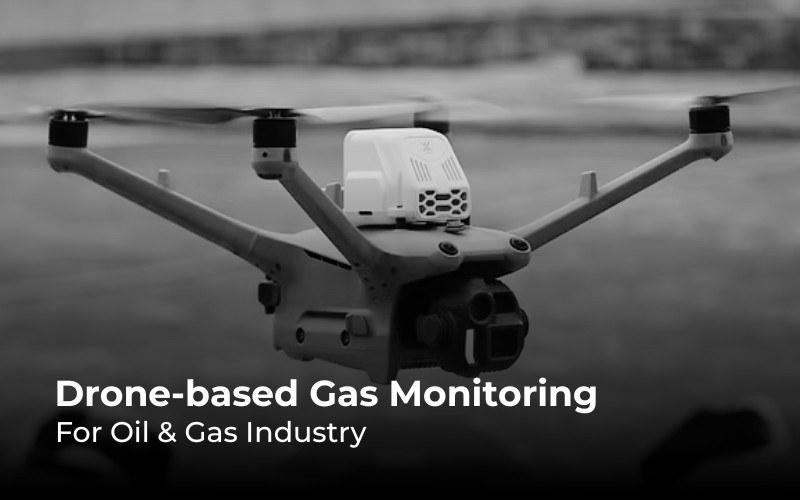
A drone survey covers the components a fixed sensor network misses and does it in a fraction of the time an LDAR crew needs on foot. Three parts make that possible, and all three are now mature enough to work as a single system:
The configuration that has emerged as the practical workhorse for this application combines:
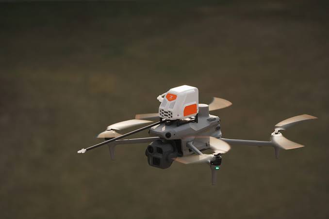
The Sniffer4D in particular is the sensor that has changed the economics of this work. It is a multi-gas analyser designed specifically for drone integration. Its lightweight, gimbal-mounted, and capable of measuring multiple gases simultaneously, including methane (CH₄), volatile organic compounds (VOCs), hydrogen sulphide (H₂S), sulphur dioxide (SO₂), carbon monoxide (CO), and ammonia (NH₃). Detection limits for the gases that matter most are in the parts-per-billion range. Every reading is GPS-tagged, time-stamped, and streamed in real time to the ground station.
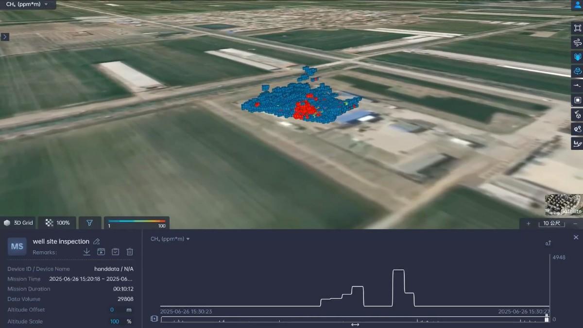
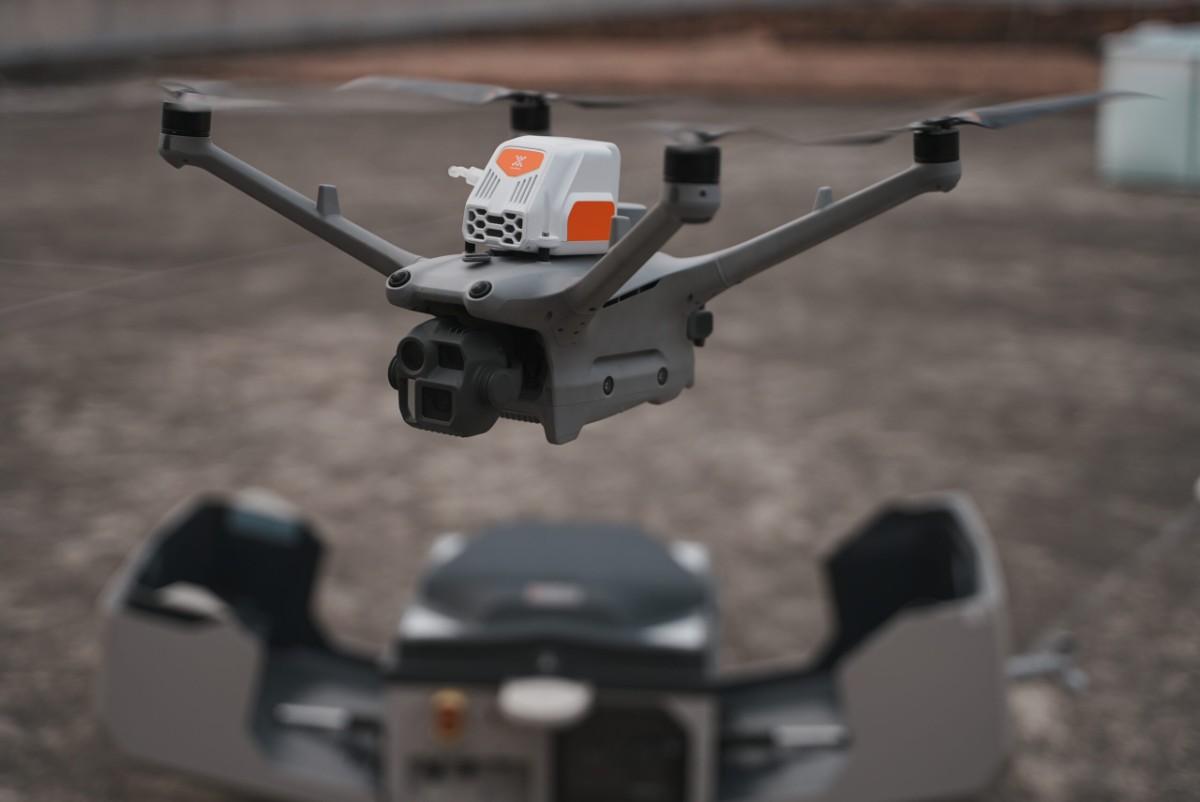
Mounted on a Matrice 400 or Matrice 4D, the system can survey a refinery, gas plant, or pipeline corridor in a span of hours rather than days. The drone flies a pre-programmed pattern at a defined height above the facility, the Sniffer4D records concentration data continuously, and Pix4D fuses the gas data with the facility’s 3D model to produce a leak-localisation heatmap. Operators see exactly where the elevated concentrations are, against the actual layout of their assets.
For a typical mid-sized gas processing facility, the field workflow takes one operator one day:
Mission planning: The facility layout is loaded into mission planning software. A grid pattern is defined at survey altitude which is typically 30–60 metres above the asset with relevant overlap suitable for the wind conditions on the day. Critical components (compressor stations, gas-treating units, storage tanks, flare lines) are flagged for closer inspection passes.
Pre-flight: The Matrice 400 or Matrice 4D is launched from a safe stand-off distance. The Sniffer4D is calibrated and checked. Wind conditions are logged.
Survey flight: The drone flies the grid autonomously, with the operator monitoring telemetry. The Sniffer4D streams gas concentration data live; any reading above defined thresholds triggers an automatic flag.
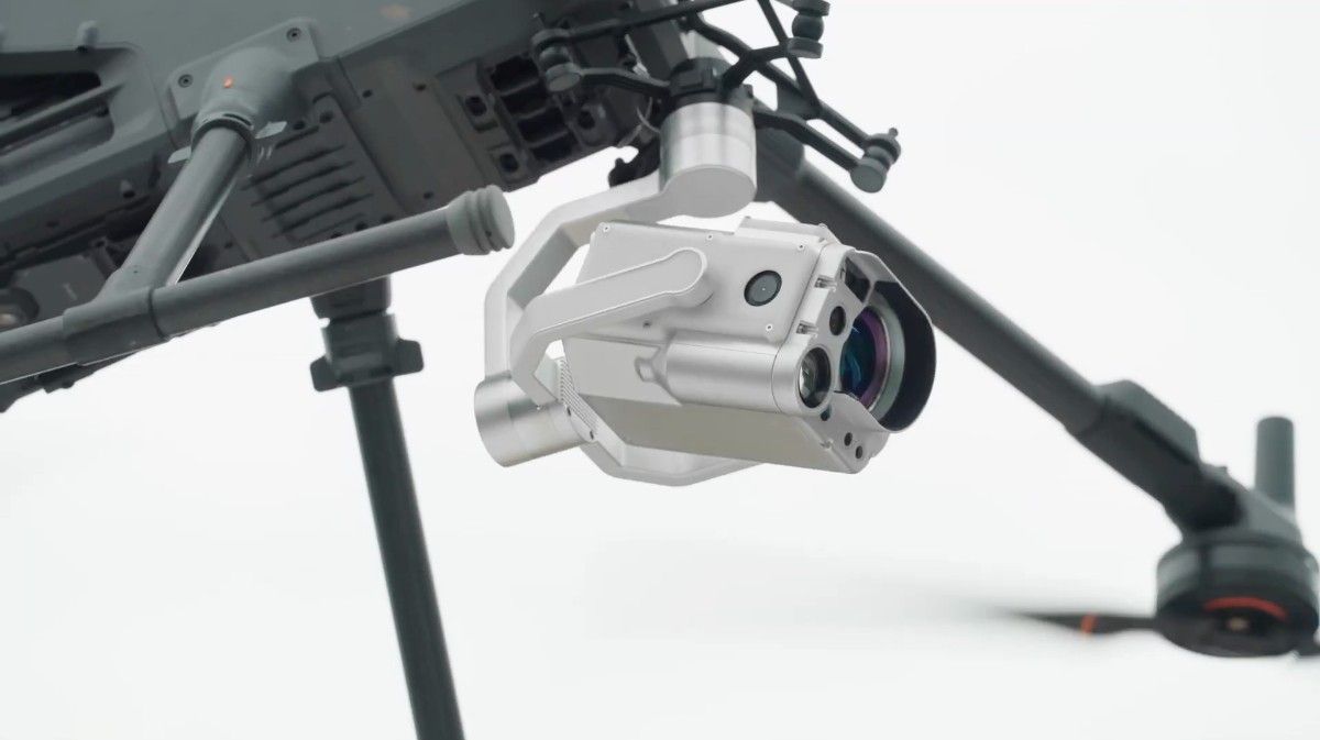
Inspection passes: Any flagged areas receive a closer follow-up flight, with the Matrice 4TD’s tele camera and thermal sensor adding visual confirmation.
Processing: Sniffer4D data is exported into Pix4D, fused with a recent 3D model of the asset, and presented as a leak-localisation heatmap.
Reporting: Output goes directly into the operator’s LDAR documentation, with each detected event tagged by GPS coordinate, concentration, and timestamp, meeting the documentation standards expected under the EU Methane Regulation, OGCI guidance, and voluntary frameworks like OGMP 2.0.
What used to be a quarter-long LDAR campaign becomes a one-day survey.The data is reproducible, auditable, and builds a survey-on-survey historical baseline operators can track over time.
The UAE’s position in the global gas market makes drone-based emissions monitoring strategically valuable in a way that goes beyond compliance.
ADNOC’s net-zero commitment by 2045 requires monthly-resolution emissions data across hundreds of upstream and midstream assets. That frequency is only achievable with automated, drone-based monitoring at scale.
LNG export markets are tightening, and the EU’s methane regulation imposes intensity thresholds on imported gas. Reliable, third party-verifiable methane intensity data is increasingly part of the commercial conversation, not just the ESG report.
The UAE as the country that had hosted the COP28 has positioned it as a global standard-setter for oil and gas decarbonisation. Operators here are pacing what the rest of the industry will be doing in five years.
The operating environment matters: Temperatures over 50°C, dust, salt air, and the sheer scale of UAE upstream and downstream assets make drone-based monitoring particularly suited to the region. The combination of an IP55 enterprise drone, an advanced gas sensor, and PPK-grade positioning is well-matched to the conditions.
For operators evaluating this capability, the practical question is whether to assemble the components piece by piece. This requires drone from one vendor, sensor from another, software from a third, or to procure the complete configured solution. The case for an integrated package is straightforward: every link in the chain has to work with every other link, calibration has to be consistent across components, and field training has to cover the whole workflow rather than three separate ones.
An integrated emissions-monitoring package for a Gulf operator typically includes:
For multi-site operators, the package extends naturally to DJI Dock 3 + Matrice 4D deployment for unmanned, scheduled surveys at major facilities and the same drone-in-a-box model used in first-responder deployment, repurposed for periodic emissions verification.
Operators using this system tell us the data does more than tick a regulatory box. Each survey adds to an emissions baseline. Over time, the trend shows whether repairs are working. The data also helps with operational decisions – which compressors to service first, which valves to replace, which assets are slowly getting worse. That makes emissions monitoring a useful business tool, not just a reporting requirement.
For operators planning their methane monitoring strategy, the question is no longer whether drone-based detection works. It is which configuration fits the asset profile, the regulatory framework, and the reporting cadence already in place. Get in touch to talk through where drone-based gas detection fits into your monitoring workflow.