Construction sites use RTK-enabled mapping drones for progress monitoring. Which one you need comes down to three things: the size of the site, how often you want to fly it, and what you need to measure. Those answers point to a compact drone like the DJI Mavic 3E, a mid-size Matrice 4E, a docked system, or a fixed-wing aircraft.
A monthly progress claim usually rests on a walk of the site, a handful of photos and a quantity surveyor’s judgement. That holds up until the main contractor and the subcontractor disagree about how much of the deck was poured in week 14, and nobody has a dated record to settle it.
The useful thing about a drone here is not the view from above. It is that you can fly the same path in week 14 that you flew in week 10, and lay one result over the other. Earthworks volumes become a subtraction instead of an argument. Slab progress becomes a percentage the client can check for themselves.
That changes what you look for on a spec sheet. A one-off aerial photo needs a good camera. A survey you intend to repeat for the next two years needs three other things.
The first is a saved flight path the aircraft can fly again without a pilot improvising. The second is RTK positioning, which pins each image to real-world coordinates. On DJI enterprise platforms an RTK fix gives you 1 cm + 1 ppm horizontally and 1.5 cm + 1 ppm vertically, and without that kind of accuracy this month’s model will not sit cleanly on last month’s. The third is a mechanical or global shutter. A rolling electronic shutter reads the sensor line by line, so it smears geometry while the aircraft is moving, and that distortion carries through into your measurements. A mechanical shutter avoids it by freezing the frame physically, and a global shutter does the same thing electronically, reading every pixel at once.
Most enterprise mapping drones tick all three, so those requirements narrow the field without choosing for you. What separates the platforms is how they answer the three questions below.

Site size decides how much ground the aircraft has to cover before the battery runs out, so start there.
Anything up to roughly 50 hectares (0.5 sq km) is comfortable territory for a compact mapping drone. The DJI Mavic 3E is the usual pick: a 4/3 CMOS 20 MP wide camera with a mechanical shutter, up to 45 minutes of flight time, 1,050 g at takeoff, and centimetre accuracy once you fit the RTK module. It goes in a backpack, which matters more than it sounds. The person flying it can be a site engineer with a free morning rather than a full-time pilot.
Above that, area stops being the hard part and congestion takes over. Tower cranes, scaffolding and half-built structures make for awkward flying, and you want more margin than a compact drone gives you. The DJI Matrice 4E covers it. You get the same 20 MP 4/3 wide camera and mechanical shutter, 48 MP medium tele and telephoto cameras, up to 49 minutes in the air, and omnidirectional binocular vision with a 3D infrared sensor that sees from 0.4 m out to 200 m. The telephoto cameras earn their keep twice over, because a pilot can read facade detail without flying close to the structure.
Past a few hundred hectares (2 to 3 sq km), a multirotor is the wrong tool. A masterplan development or a long infrastructure alignment would eat a full day and a stack of batteries. A fixed-wing VTOL like the Quantum Systems Trinity Pro takes off vertically, transitions to wing-borne cruise and stays up for 90 minutes, covering up to 700 hectares (7 sq km) in a single flight. It weighs 5.75 kg, and the payload bay takes RGB, oblique, multispectral or LiDAR sensors. On a fixed-wing the shutter comes with the payload rather than the aircraft, so check it when you specify: the Phase One P5 uses a global shutter and the Sony ILX-LR1 a mechanical one.
Size gets you down to two or three aircraft. Who flies them is a separate question, and it is worth answering before you buy anything.
Flying once a month costs one person a morning. Flying weekly through the earthworks phase means booking that morning every week, plus the processing time after it. Flying daily is more than a site engineer can absorb alongside their own work, so it becomes either a dedicated role or an automated system.
For monthly or occasional flights, a pilot-flown drone is the sensible answer and everything above applies. The aircraft lives in a case, comes out when it is needed, and most of the cost is the pilot’s time.
Fly more often than that and getting a pilot to site starts to cost more than the hardware. A dock takes that out of the equation. The DJI Dock 3 with a Matrice 4D keeps the aircraft in a weatherproof enclosure on site, where it flies its mission on schedule, lands, charges and uploads with nobody present. The dock is rated IP56 and the aircraft IP55, the system runs from minus 20°C to 50°C, charging takes about 27 minutes, and the operating radius reaches 10 km. The M4D weighs 1,850 g, flies for up to 54 minutes, and keeps the 4/3 20 MP wide camera and mechanical shutter that survey work needs. Specify that variant rather than the 4TD, which trades the mapping camera for a thermal one on a smaller 1/1.3-inch sensor with an electronic shutter only. Dock 3 also mounts on a vehicle, which suits a contractor covering several plots.
There is a real trade here. A dock costs more up front and needs a fixed position with power and connectivity. It earns that back on a long programme, where the alternative is sending someone out fifty times a year.
This is the question that decides the sensor, and the easiest one to skip.
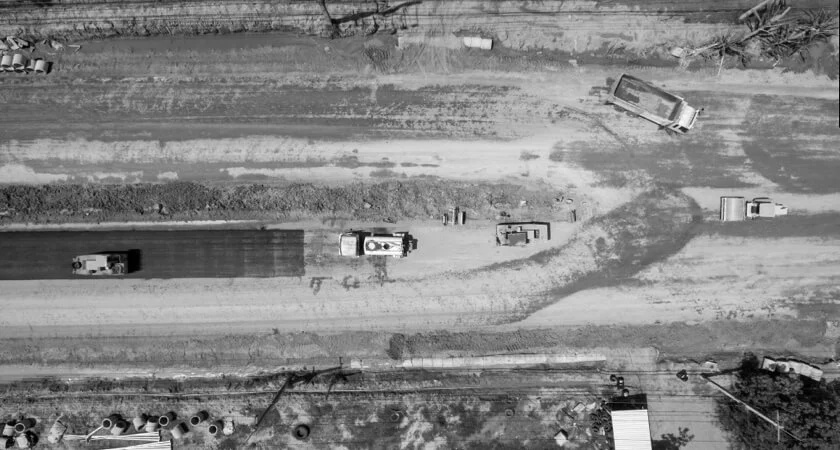
For a visual record that supports claims and stakeholder reporting, an RGB camera does the job. Processing turns the images into an orthomosaic: a flat, measurable aerial photo of the whole site with lens and terrain distortion corrected out. For progress work it is the single most useful output you can have.
For volumes during earthworks, you need that same imagery plus dependable vertical accuracy, and RTK stops being optional here. Processing gives you a digital surface model and a digital elevation model, which is height across the site and the basis of any cut and fill figure.
Photogrammetry covers this on most sites and costs less to fly and process. The catch is how it works. It infers depth by matching features between overlapping photos, so its accuracy depends on conditions the site has to supply: texture to match on, even light to shoot in, and a spread of ground control to hold the model down. With all three, you are looking at roughly 1 cm to 2 cm horizontally and 2 cm to 3 cm vertically. The vertical figure is the looser of the two, and a volume is a vertical measurement.
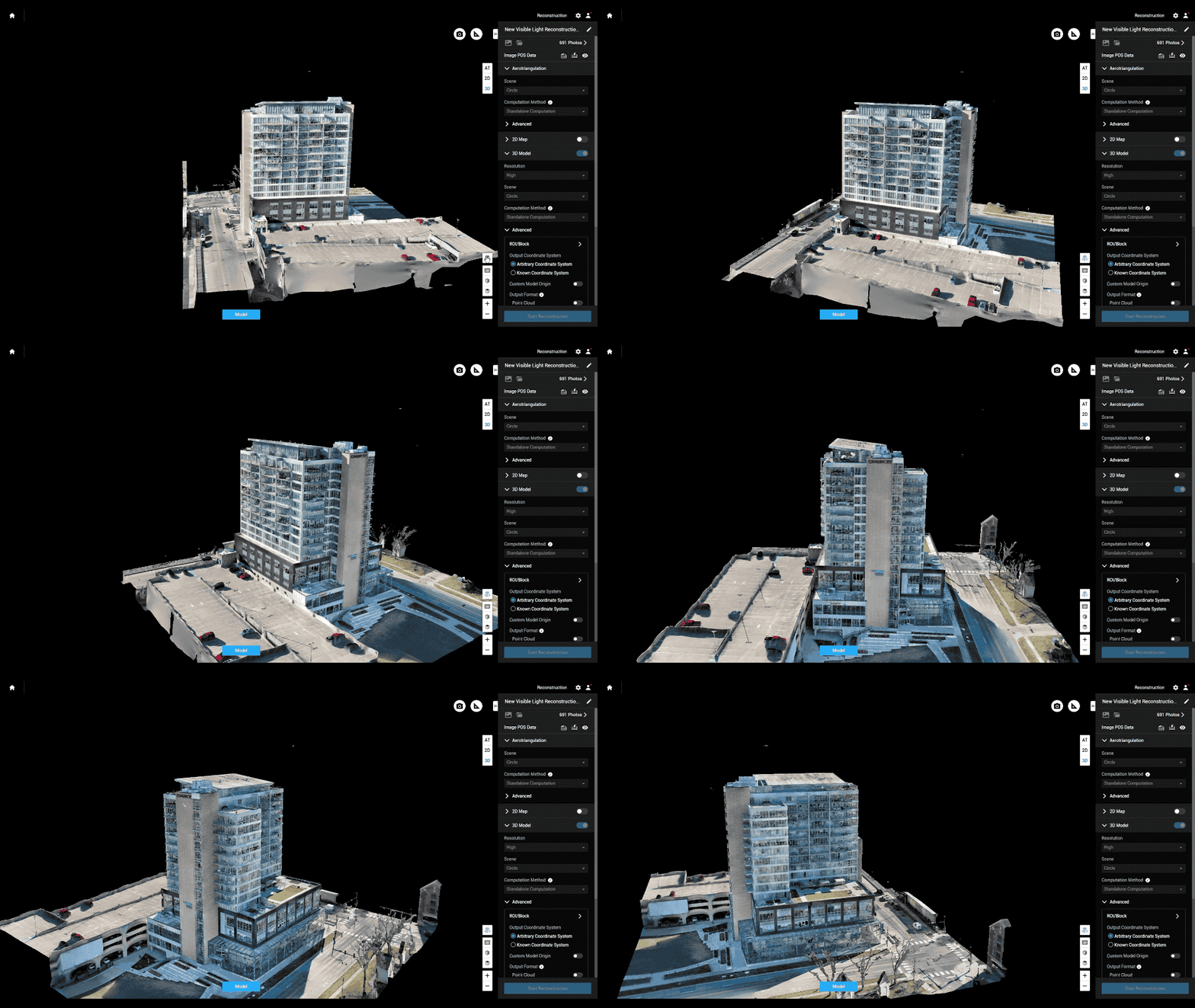
LiDAR measures the distance to each point directly rather than inferring it, so texture and light stop mattering. DJI’s current survey payload, the Zenmuse L3, quotes 3 cm vertical and 4 cm horizontal accuracy at 120 m under its own test conditions, with vertical the tighter of the two, which is the reverse of photogrammetry. On a construction site that shows up in specific places. Fresh concrete, uniform sand fill and dark asphalt give a camera very little to match on. Harsh midday shadow does the same. Steep excavation walls and stockpile faces at the angle of repose are awkward to reconstruct from a nadir photo run. LiDAR also flies at night, when the cranes are parked and the site is still.
Checking what was built against what was designed asks for more again. Here you want a point cloud dense enough to clash against the BIM model, and the accuracy argument above applies with more force, because a clash tolerance is tighter than a volume tolerance. That is where a heavier platform starts to make sense. The L3 mounts on the DJI Matrice 400, which flies for up to 59 minutes and carries 6 kg of payload. The rotating LiDAR and mmWave radar on that aircraft are for obstacle sensing rather than survey, so the mapping work still comes from the payload you hang underneath it. It is more aircraft than progress monitoring needs on its own. It adds up when the same team also runs inspection or survey work.
The processing chain barely changes across the three. DJI Terra and Pix4D turn images into orthomosaics, models and point clouds. DJI FlightHub 2 stores the flights and compares a current map against older ones, which is the step that turns a folder of surveys into a progress record. From there, most contractors push the outputs into whatever construction management platform the project already runs on.
| Site | Frequency | What you need | Platform |
|---|---|---|---|
| Up to 50 ha (0.5 sq km) | Monthly | Ortho 2D & 3D | Compact mapping drone (Mavic 3E class) |
| 50 to 200 ha (0.5 to 2 sq km), congested | Monthly | Ortho 2D & 3D | Mid-size mapping drone (Matrice 4E class) |
| Any size, multi-year | Daily or weekly | Regular Progress Monitoring, Site-wide Ortho | Docked system (Dock 3 with M4D) |
| Above 200 ha (2 sq km) | Per milestone | Site-wide orthomosaic | Fixed-wing VTOL (Trinity Pro class) |
| Any size | Per milestone | Volumetric Analysis, 2D Orthos & 3D | Heavy-lift with LiDAR (Matrice 400 class) |
Commercial drone work in the UAE needs a registered aircraft, a certified pilot and approval for the location. Operators in Dubai deal with the DCAA, inside the national framework the GCAA sets. Sites near airports, heliports or restricted airspace need extra clearance and more lead time, so put the approval in the programme rather than in the week before the flight.
Answer the three questions for your own site before you open a single product page. Most contractors end up with a compact or mid-size RTK mapping drone, a processing licence and one trained pilot on the team. A dock starts to pay back on sites running two years or more, or where a contractor is juggling several plots at once. Anything measured in square kilometres wants a fixed-wing.
The Drone Centre supplies DJI Enterprise, Quantum Systems and other survey platforms across the UAE, along with the payloads, software and training that go with them. Contact our team if you want to talk it through against your own site.