Drones for Good: The Integration of Aerial Systems in Environmental Protection and Humanitarian Aid

Drones For Good - A drone flying over a savannah scanning for wildlife
While Earth Day recently passed, it continues to serve as a global reminder of our urgent responsibility to protect the planet's ecosystems and biodiversity. Today, drones are directly answering that call, providing the critical technological link needed to turn conservation goals into reality.

Share This Post

A quiet but significant shift is underway in the commercial drone sector, one that is redefining how aerial systems are deployed to protect the environment, track biodiversity, and safeguard global public health. While the integration of unmanned systems into industrial logistics is well documented, advanced sensors, automated flight systems, and heavy-lift capabilities are now being embedded directly into the workflows of conservationists and first responders.

The implications for global sustainability and emergency management are wide-reaching and permanent.

From Reactive Patrols to Automated Conservation Systems

For decades, vast ecological reserves have relied on ground patrols to monitor endangered species and deter poaching. This approach is inherently reactive, limited by the sheer scale of the terrain and the speed of human deployment. The integration of automated drone docks is changing this dynamic completely.

At the Babanango Game Reserve in South Africa, time is the critical variable in wildlife protection. To bridge the gap between a perimeter alert and a physical response, conservation teams have integrated the DJI Dock 3 into their security infrastructure. Operating as an autonomous, weather-hardened hub, the dock enables immediate aerial deployment the moment a fence alarm or ground sensor is triggered. Equipped with high-resolution thermal imaging, the dispatched drone navigates the darkness to identify the heat signatures of both vulnerable wildlife and unauthorised personnel.

This real-time intelligence transforms a blind, multi-hour ground search into a precise, targeted interception. It is a massive force multiplier for conservation teams fighting organised poaching networks.

A DJI Dock 3 deployed for wildlife emergency response
Use of automated drone docks for conservation efforts around the globe | Image Credit: DJI

Unlocking the Rainforest Canopy with eDNA

What lurks in the highest reaches of the rainforest canopy has long remained a mystery to conservationists. Traditional tracking methods, such as camera traps and acoustic monitors, routinely miss elusive or quiet species that live high above the forest floor.

To solve this, researchers from ETH Zürich and Wilderness International have pioneered a method of deploying drones to collect environmental DNA (eDNA) directly from treetops in the Peruvian Amazon. Equipped with a specialised, automated probe and a moist cloth pad, these drones hover above the dense canopy and lower the apparatus to rub against leaves and branches. This process gathers genetic material—such as hair, fur, or saliva—left behind by canopy-dwelling animals.

Recent deployments using this technique successfully detected an astonishing 257 vertebrate species, with a single canopy sample identifying up to 50 distinct taxonomic groups. By turning unmanned systems into aerial genetic samplers, ecologists are unlocking a wealth of previously inaccessible biodiversity data, which is proving critical for establishing and funding new conservation areas.

Researchers setting up drpmes for eDNA capture with drones from forest canopies
eDNA sampling initiatives powered by drones | Image Credit: Matthis Webber

Aerial AI vs. Mosquito-Borne Disease

The integration of aerial systems is also proving to be a formidable tool in global public health. As warming temperatures push mosquito-borne diseases like dengue and Zika into new geographic regions, eliminating urban breeding grounds has become an urgent priority.

In Makassar, Indonesia, researchers from Stanford University recently used drones and AI to hunt down these hidden environmental threats. Discarded tyres are notorious breeding sites for Aedes aegypti mosquitoes, as they hold stagnant rainwater, provide ideal shade, and remain undisturbed. However, they are often practically invisible to ground crews, hidden behind fences, on rooftops, or under dense vegetation.

By flying drones over sprawling urban landscapes and processing the high-resolution imagery through deep learning convolutional neural networks, the AI systems successfully identified nearly twice as many hidden tyres as human analysts reviewing the same data. This capability drastically reduces operational latency, allowing public health officials to deploy highly targeted vector control strategies and eliminate breeding sites before localised disease outbreaks can occur.

Drones used for detecting mosquito breeding grounds
Drones and AI combatting mosquito-borne diseases | Image Credit: Standford Global Health

Precision Thermal Sweeps in Agriculture

The benefits of thermal and aerial technology extend into agricultural environments, where they are actively preventing wildlife casualties. Each spring, traditional farming practices unintentionally threaten newborn fawns, which instinctively hide in tall grass to evade predators. When heavy mowing equipment moves in, these animals remain perfectly still, often resulting in tragic fatalities.

To mitigate this, coalitions of drone operators and farmers are adopting proactive aerial sweeps. Utilising platforms like the DJI Matrice 4T drones, pilots scan agricultural fields just before sunrise. The sharp contrast between the cold morning earth and the radiant heat of a resting animal makes detection immediate and highly accurate. Ground volunteers are then directed to specific coordinates to safely relocate the fawn before machinery arrives, saving thousands of animals annually without disrupting agricultural schedules.

A drone being used for crop health monitoring in an agricultural field
Drones being deployed above agricultural fields to obtain multispectral and thermal data | Image Credit: DJI

Mapping the Health of the Ecosystem

Effective conservation requires an accurate baseline understanding of the environment, a demand that outdated satellite imagery struggles to meet. Modern drones are replacing these legacy methods with localised, hyper-accurate data collection. Systems equipped with multispectral sensors capture light beyond the spectrum of human vision, identifying plant stress weeks before visual degradation occurs and allowing ecologists to spot invasive diseases early.

To scale these operations across vast ecological reserves, organisations are turning to specialised platforms like the Quantum Systems Trinity Pro. As an electric vertical take-off and landing (eVTOL) fixed-wing drone, it launches in tight spaces like a helicopter but transitions to forward flight for maximum aerodynamic efficiency. This allows conservationists to map thousands of hectares of forests and wetlands in a single flight, generating the topographical datasets necessary to track long-term environmental shifts

A Trinity pro drone flying over forest land for aerial survey
Quantum Systems Trinity Pro deployed for a long range aerial survey of forest land | Image Credit: Quantum Systems

Precision Delivery for Remote Conservation Zones

Beyond observation, the role of drones in physical environmental intervention is rapidly expanding. Heavy-lift systems like the DJI FlyCart 100 are engineered to navigate deep into geographically isolated terrain without leaving a human footprint. Carrying substantial payloads of targeted animal feed or biological agents for habitat treatment, these drones cross impassable landscapes in a fraction of the time required by ground logistics.

In dense forests or protected wetlands where a physical landing is impossible, automated winch systems allow the drone to hover safely at altitude, lowering conservation gear or urgent medical supplies directly to wildlife response teams on the ground.

A Future Driven by Purpose

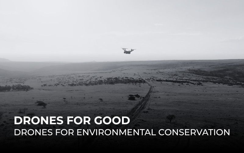
The shift toward deploying drones for conservation reflects a broader implication of the unmanned aerial vehicle market. Technology is no longer being developed solely for commercial profitability; it is being engineered to serve fundamental global sustainability needs.

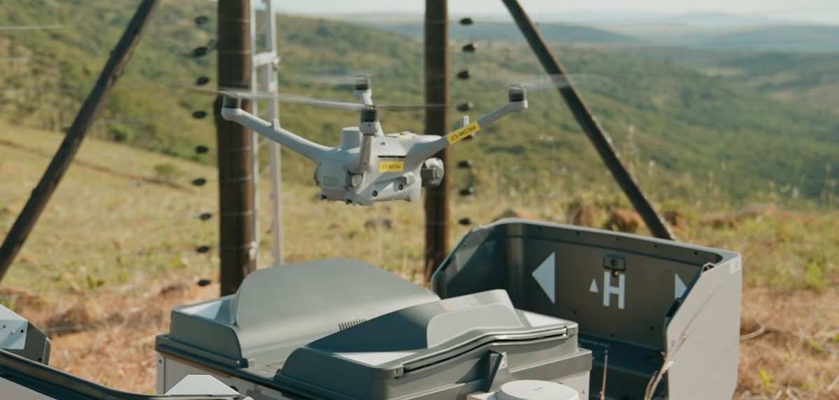
As automated drones, drone docks, genetic sampling probes, AI-driven public health models, and heavy-lift platforms become deeply embedded into the daily operations of conservationists and relief workers, the standard for emergency response and environmental protection is rising. The technology has finally caught up to the mission. The impact will be permanent and self-sustaining!

Ready to elevate your environmental initiatives? Reach out to our team to seamlessly integrate precision drone systems into your next conservation project.

📞 +971 4 591 8661 📧 hello@thedronecentre.ae 🌐 www.thedronecentre.ae

Subscribe to Our Newsletter

Get updates and learn from drone professionals, get notified of the latest best practices in drone technology delivered personally to your inbox.

More To Explore