Our Findings on LiDAR Mapping Solution – DJI Zenmuse L1
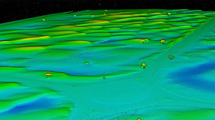
Announced late last year, DJI’s first Livox LiDAR payload- the DJI Zenmuse L1- was set to change the game. The L1 comes seamlessly integrated with the DJI M-300 and DJI Terra software, giving you a completely self-sufficient ecosystem. We were excited to test out the new system and took it to the field as soon as we got it; here are our findings.
How is DJI Zenmuse P1 Resolving the Problem of a Texture-less Desert?
Precise & Rapid – These are some of the fundamental requirements of Geographic Systems. SfM (Structure from Motion) software is often at the core of drone photogrammetry; it is the method of choice for processing data from surveying, mapping and remote sensing. In this case study we will take a look into the issue of a ‘textureless’ desert and how DJI Zenmuse P1 solves this problem and makes mapping the deserts no longer a challenge.
8 Reasons Why You Should be Talking About DJI Zenmuse P1
From its announcement in October 2020, the DJI Zenmuse P1 has been making wakes in the photogrammetry world. Photogrammetry experts longed to get their hands on it and give it a try. Well, we managed to secure a demo unit and here’s what our experts had to say.