How DJI Zenmuse L1 Makes Right of Way Surveys Flexible and Practical
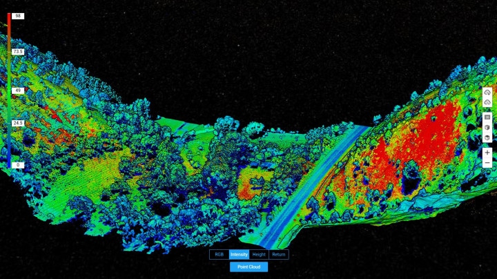
Right of Way (ROW) Surveys are tricky but incredibly important to Power & Utilities companies looking to expand their power grid. Especially in areas with dense vegetation and tree growth, in these areas, photogrammetry cannot provide bare ground level elevations. Without a reliable DTM (Digital Terrain Model), the next set of substations and power lines cannot begin. This is where LiDAR comes in. Using drone-powered LiDAR -DJI Zenmuse L1, we were able to survey the modest stretch of land quickly, efficiently and cost-effectively.